Prespes 2026 - Triethnes+
Date: August 21, 2026
Region: Western Greece, Epirus & Western Macedonia, Greece.
Partners: Solo
Overview
August in Greece is synonymous with ones’ annual vacation, usually to some relaxing island destination, or even ones’ parent’s village, however, in our case our destination are some ancient lakes in a deep-inland and remote corner of Greece. Running for its 2nd year Triethnes+ Festival would once again fill the air of Prespes Lakes (”Πρέσπες”) with sounds, and we would be remiss to be absent. After all, it is one of the only times I get to see Jay since he moved to Germany. This year, our journey would take us through Western Greece, as it did in 2024, and offer us four (4) full days of road-tripping through some of the country’s best scenery.
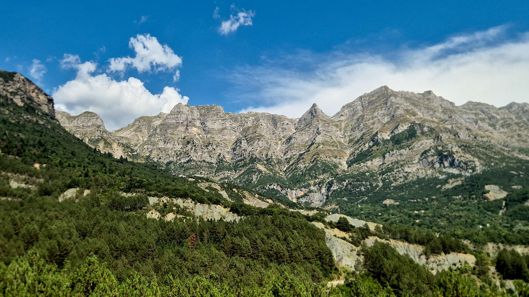
Gerakovouni (2,364m) in Tzoumerka under which we climbed.
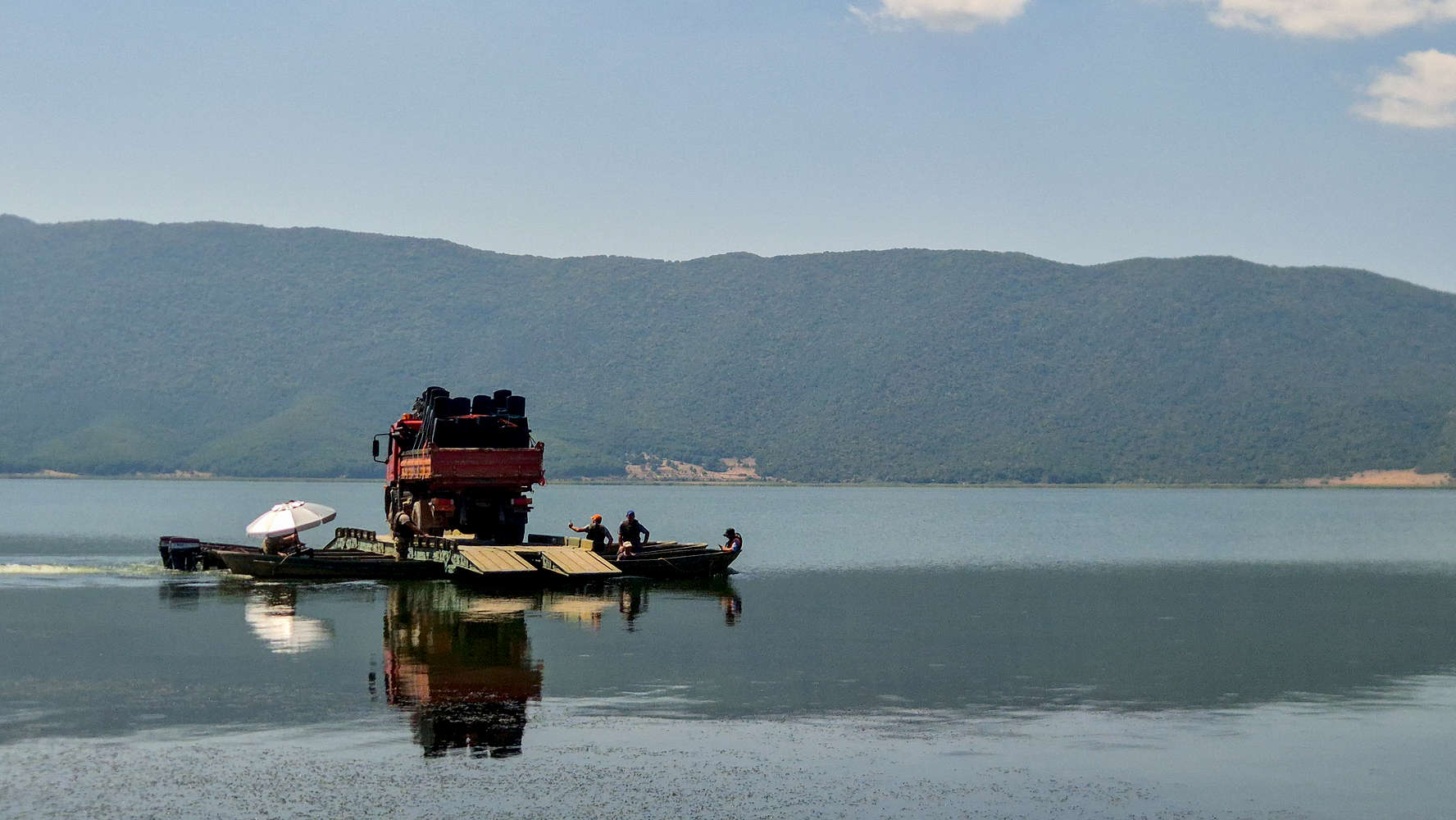
Truck being ferried from Ag. Achilios on Little Prespa.
Our road trip would focus more on peripheral activities instead of peakbagging, a contrast to 2025. I looked forward to experiencing this itinerary since it included both more relaxing activities catering to Aris & Nieve, but also since it would be our first serious road trip after completing my lead climbing course in June & July. As it would turn out, despite the heat, sport climbing would offer an engaging but welcome respite – at least for the mind. Nonetheless, the trip would also offer us the opportunity to summit one (1) more 2,000m peak, and one which is logistically complex as a day-hike at that.
Once in Prespes, our main concern was to engage with the festival, especially with Aris having actively joined the organizing team this year. Besides this, Nieve was excited for relaxation, plenty of beach time, and good food, while I openly maintained hopes of plentiful morning solo hiking, which were quickly dashed by a combination of late-night Tsipouro binges and the intense heat.
“The pale flowers of moonlight,
Those roses made of light,
Bloom in the nights of summer:
If only I could pick one!”
— Colombine, Albert Giraud, St. 1.
This Trip Report turned out a little different, mainly since we did so little peakbaggin. Yet the trip proved equally beautiful and worthwhile in every sense. We were exceedingly lucky to have been offered so much by the regions we stayed in the most, namely Tzoumerka (“Τζουμέρκα”) and Prespes. The scenery, people, food, climbing, hiking, swimming, weather… everything was as good as it could; thus, lending well to memories (and friends) made at lower elevations.
Interactive Map
Day 1: Messolonghi
We departed Athens at 15:30 and were able to beat some of the Friday afternoon traffic. Unlike our trip last year, the relatively short distance to Messolonghi (”Μεσολόγγι”) would allow us to enjoy some of the afternoon sun after our arrival. As such, reaching near Kryoneri (”Κρυονέρι”) and Varasova (917m) [”Βαράσοβα”] at 18:30, I recommended we go directly to dinner, but was overruled and instead we drove the final 30 minutes to our hotel in Agriilia (”Αγριλιά”); to at least leave our gear before heading into town.
Lagoons & Tourlida
Back in the car after 30 minutes, we caught the end of daylight. Unfortunately, Aris would not get to visit the Garden of Heroes (”Κήπος των Ηρώων“) park at the town center, with it closing as we arrived. Instead we drove the lagoon-road to the village — and once an island — of Tourlida (”Τουλίδα”), where we could also have dinner. The lagoon offers a unique ambiance, especially during sunset, which is amplified by the unique homes built on stilts called Pelades (”Πελάδες”). It was protected as early as 1971 under Ramsar, but also via Natura 2000 (GR2310015 & GR2310001), and now makes up the Messolonghi Wetlands & Western Greece National Park.

The sunset over Messolonghi Lagoons.
Sadly, we didn’t get a good glimpse of any of the 130 species of protected birds while enjoying the sunset at Tourlida beach (ELBW049127032), which is rated as “Excellent” in terms of water quality, and was busy even at that hour. Our dinner awaited us just a few steps away at Tavern Sunset Tourlida (⭐4.4, +1,000). An expensive but adequate meal at a unbeatable spot, and admittedly including a lot of local seafood delicacies including Bottarga. Unable to find any obvious places to get some ice-cream afterwards, we drove back to Socrates Organic Village (⭐4.7, +250) by 23:00.
Day 2: Aetolia & Vonitsa
Our first full day of the trip would take us from the small mountains of Messolonghi, to the ancient city of Pleuron above the Salt Flats, the great Kleisoura Gorge, and then to the waters of Ambrakikos Bay, where we would be able to swim as well as climb. Hopefully we could follow that up with a dinner visit to Preveza (”Πρέβεζα”) before reaching our destination for the night, near Arta (”Άρτα”).
Arakynthos (984m)
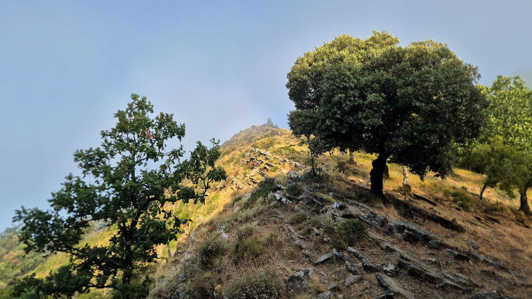
Making the short drive through the villages of the massif in the early morning, we arrived at the trailhead all alone, and enjoyed a quiet morning outing among the lush Oaks and punctuated by a chance fog which kept us surprisingly cool.
Ancient Pleuron
Having succeeded in our first summit of the trip, we managed to return to the hotel early enough for breakfast, but not early enough to beat the heat. By the time we were ready to continue on our journey the temperature had exceeded 30°C. Luckily, there was only a single serious site for us to visit, the local Classical ruins — which we learnt were newly re-opened to the public.

Gate of the cyclopean walls with views to the lagoons.

Terry at the center of the amphitheater.
Ancient Pleuron (”Αρχαία Πλευρώνα”) was once one of the largest cities of Aetolia (”Αιτολία”), and was mentioned by Homer as one of the allies which sent vessels to Troy[1]. The ruins which can be visited today make up “New” Ancient Pleuron, after its destruction by the Macedonians in 200 BCE[2], past which it only survived through the Aetolian and Achaean Leagues and thereafter via its integration into the Roman Empire[3]. Today, the primary features of interest are the 2.3Km-long cyclopean walls, described as constructed from “very large wrought blocks, […] of a remote age” by Col. W. Leake[4], along with the ancient amphitheater, both of which date to the initial stages of construction[5]. The site is managed, and a ticket is required at a cost of €5 full-price, or €3 reduced.
Panagia tis Foinikias
From the terraces of Ancient Pleuron, a small shimmering building on the lagoons bellow piqued my interest; it was the small chapel of Panagia tis Foinikias. We decided it would be our next stop, and it gave Nieve the opportunity to spot Greater Flamingos (Phoenicopterus roseus) on the salt evaporation ponds nearby. Approaching the chapel, we were taken aback, both by the exceptionally unique setting, but also in part due to people lathered in the tar-black mud of the ponds.

Looking out from Panagia tis Foinikias.
Panagia tis Foinikias (”Παναγιά της Φοινικιάς”) is a chapel on the homonymous island of the Messolonghi lagoon, and near Greece’s largest salt evaporation pond. Built in 1804 it was favored by poet, and philhellene Lord Byron (1788 - 1824) during his stay in the city. Some accounts have him contracting the cold which eventually killed him while on a horse-ride on the island[6]. With Foinikia being accessible by car it is a popular place for people to enjoy the health properties of the waters’ high salt content and the dark mud.
Aitoliko
Looking to refuel with some snacks before the longer driving section, we decided to visit Aitoliko (”Αιτωλικό”), a quaint lagoon island which could be described as Greek-Venice. Once an island, it spent most of history as a subsidiary fortification, and in 1406 was acquired by Carlo I Tocco, Count Palatine of Cephalonia and Zakynthos. The town was only connected to the mainland in 1848, and its shape today is a result of land reclamation; as recently as 1969. It is also the birthplace of engraver and political activist Vaso Katraki (”Βάσω Κατράκη”), one of the few Junta prisoners released as a result of international pressure.
Kleisoura Gorge
It took less than 15 minutes to reach the Gorge of Kleisoura (”Φαράγγι της Κλεισούρας”) from Aitoliko, arriving at the foot of Monastery of Panagia Eleousa (”Παναγία Ελεούσα”). Kleisoura is all which remains from a time when Achelous river flowed through it and to the South; with the modern-day Agrinio (”Αγρίνιο”) plains forming a giant lake. According to Strabo[7], and agreed to by W. Leake[8], it is though that the ancient town of Pylene (”Πυλήνη”) was once situated at its Western entrance.
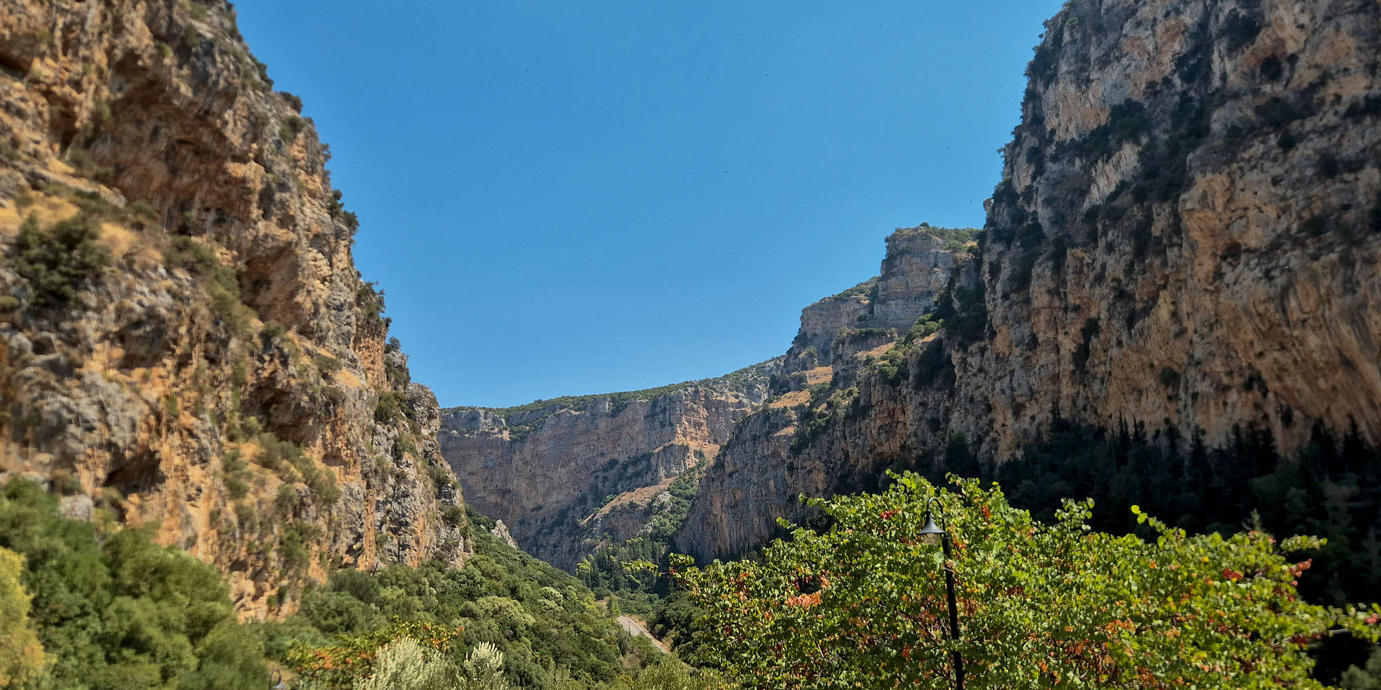
Kleisoura Gorge as seen from Panagia Eleousa.
For many years the gorge was relegated to a mere roadside attraction, however, it has since 1999 been recognized by Natura 2000 (GR2310010) and the HOS (GR092) as a site of ecological interest, especially in relation to the presence of the Eurasian Griffon Vulture (Gyps fulvus). More recently, the gorge has shone as the “cathedral” of sport climbing in Western Greece, with Kleisoura Crag featuring over 40 single-pitch sport routes from Fr 6a to 8c.
Koukoumitsa Island
Soon we were driving the longest leg of the day, from Kleisoura towards Vonitsa (”Βόνιτσα”). Our plan was to climb and swim before moving on to Arta (”Άρτα”) via Preveza (”Πρέβεζα”). As we pulled up near Koukoumitsa Island (”Κουκουμίτσα”) the temperature precluded us from thinking about climbing, instead we settled on the near empty beach (ELBW049124003) where Nieve had a swim. She then joined me for a quick walk onto the small bridged-island just by the beach.
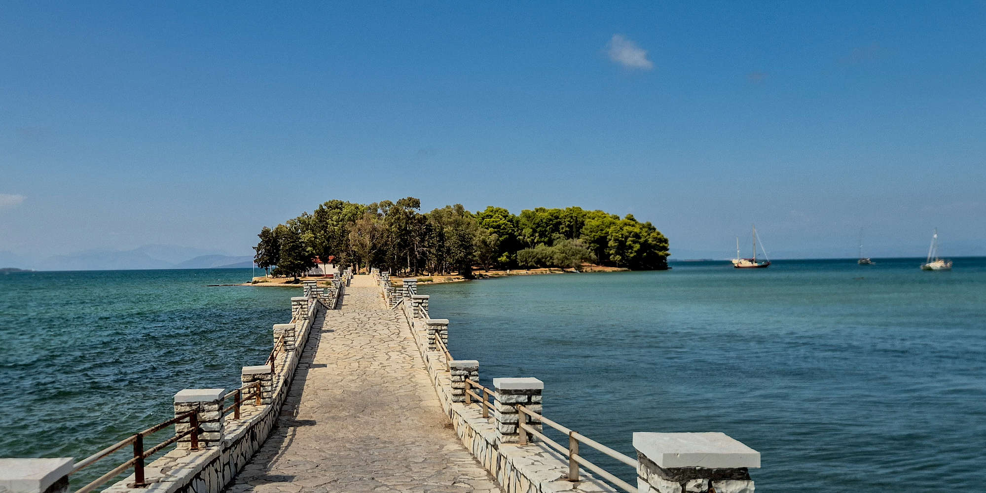
The pedestrian bridge leading onto Koukoumitsa.
The island of Koukoumitsa is one of many features of the Ambracian Gulf (”Αμβρακικός”), a large but shallow inland gulf between Vonitsa, Actium (”Άκτιο”), and Arta, that is recognized for its ecological importance by Ramsar and Natura 2000 (GR2110001). Within it fauna abounds, including bottlenose dolphins (ursiops truncatus), as well as the endemic and endangered ray-finned loach (Cobitis arachthosensis).
Once across the bridge, we walked under the pleasant shade of the lush pines which are found on the island. As we were sitting by the bay, we received a phone call from Terry and Aris who were ready to leave, rather unhappy with the beach. Not wanting to eat in Vonitsa, we got on the road.
Drive to Arta
Looking for greener pastures elsewhere, we found little around Preveza. The strong winds meant the Ionian was frothy, but even so every organized beach we drove past was packed. Not particularly looking forward to walking around the empty city in the mid-day heat, we continued to Hotel Marathia (⭐4.5, +250), at Chanopoulo (”Χανόπουλο”), near Arta. We arrived and checked-in at around 17:00.
With much daylight left, us being practically trapped an hour from the sea, and the real-feel temperature nearing 40°C, Terry and Aris were not up to staying in Arta. In a desperate bid to escape the heat, they booked a last minute hotel in Vourgareli (”Βουργαρέλι”), about 1 hour away. With nothing better to do, by 18:00 we were back in the car.
Extension to Vourgareli
A quaint drive through mountain roads brought us to Rouista Tzoumerka Resort (⭐4.8, +1000) in the village of Vourgareli in the shadow of the Athamanika Group of the Tzoumerka mountain range. We settled into our suprisingly luxurious room, and enjoyed some drinks before finishing the night off at the hotel restaurant, Bostani - Greek Mountain Cuisine (⭐4.7, +100). I considered sleeping early for a solo hike that morning but gave up on the idea.
Vourgareli (”Βουργαρέλι”) is a traditional stone-built village situated at the foot of Sklava (2,088m) [”Σκλάβα”], on the South aspect of the Athamanika (”Αθαμανικά”) massif, crowned by Katafidi (2,393m) [”Καταφίδι”]. It has been inhabited since at least the 14th century, with the Red Church (”Κόκκινη Εκκλησιά“) constructed as a monastery catholicon dating to 1281[9]. It is protected under two Natura 2000 zones (GR2110002 & GR2130013), as well as classified by the HOS (GR079), due to the high degree of avian biodiversity, alongside the presence of rare wildlife such as bears, otters, and fish.
It is thought that the Red Church of Vourgareli was built by the same stonemasons as the Agia Klimi church in Ochrid, North Macedonia.
Day 3: Athamanika
For our second full day of the trip, we were without a plan, seeing as though we were nowhere near where we had originally expected to be. As a result we would be missing what would have been a rather busy day along the sea, instead I convened with Terry at breakfast to figure something out. With the temperatures slated to be some of the highest, we opted to stay along the mountains, setting course for some sport climbing at 1,300m, and eventually making our way to our days hotel.
Captain’s Baths
With some time to spare before leaving Nieve and I decided to make the small hike to the “Captain’s Baths” (”Λουτρά Καπετάνιου”), easily accessible from our hotel via a marked trail. The route, 1.3km in length, and requiring +132m of gain on the return, leads from a village stone-path (T1) onto a dirt road (T0), and then past a ruin, arriving at the Kalamas (”Καλαμάς”) ravine where some rock-hopping and platforms bring one to the final roped passage (T3) into the ‘baths’, in about 20 minutes.

Trail signage leading to Captain’s Baths.
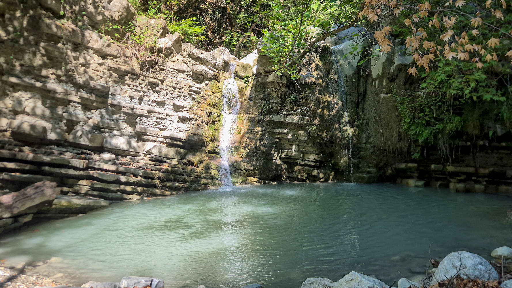
The primary waterfall at Captain’s Baths.
We were not looking to swim at this hour, and instead relaxed by the running waters, near white in color from the high concentration of lime. A few other people were braver, dipping into the main pool. Waiting for the Terry & Aris to get ready we hiked back up to the village, which was less than pleasant since even up here at 850m the temperature easily exceeded 30°C.
Kryopigi Crag
From Vourgareli we drove directly to the village of Katarraktes (”Καταρράκτες”), where we could combine sightseeing with sport climbing, remain at a high elevation, and on route to our day’s destination. The Kryopigi (”Κρυοπηγή”) crag — literally, cold spring — is situated to the side of each of two giant waterfalls, and therefore can only be climbed when dry. Since it is a popular nature sight, the Atrapos Tzoumerka cafe (⭐ 4.4, +250) is located at the start of the trail, within the old information center. The more popular right sector offers airy slab climbing on bullet-hard alpine limestone right next to the falls. The bolt spacing is on the brave side of average and there is little evidence of maintenance with some bolts looking questionable. Most easy routes are overgrown.
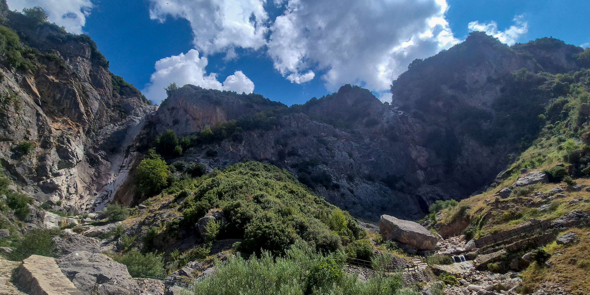
The twin waterfalls of Tzoumerka.
Finding the belaying shelf right by a stream of ice cold water, the name was soon vindicated. I started by climbing “The Dihedral” (4c, 20m), an easy line on great limestone with an engaging mantel move, made harder by the overgrowth. Climbing in such heat was tedious but at least returning to the ground meant putting my sweltering hot feet into the cold water. After a long break I tied in for “The Bride” (5b, 28m), a route tackling an overturned corner into an airy slab finish, a sandbag for the grade and the crag and tricky to onsight.

At the crux mantel of “The Dihedral”.

Almost at the anchors on “The Bride”.
An hour of climbing in these conditions was exhausting enough, so we called it a day and made our way back to the cafe where I got a beer, chatted with Nieve, and was eventually invited over by local Christoforos V. who had filmed me climbing. We spent nearly another 2 hours at the cafe, enjoying cold beverages and the nice view before continuing on towards Kalarrytes (”Καλαρρύτες”).
Leaving Athamania
Our drive took us below some of the most spectacular alpine terrain in Greece. Nearly completely surrounded by massive limestone faces, steep summits, and large forests, it was hard not to stop at every turn. Nieve didn’t fall asleep quickly as these scenes unraveled through her window; what must she be thinking? As for myself, I allowed music texture this wonderful mosaic.
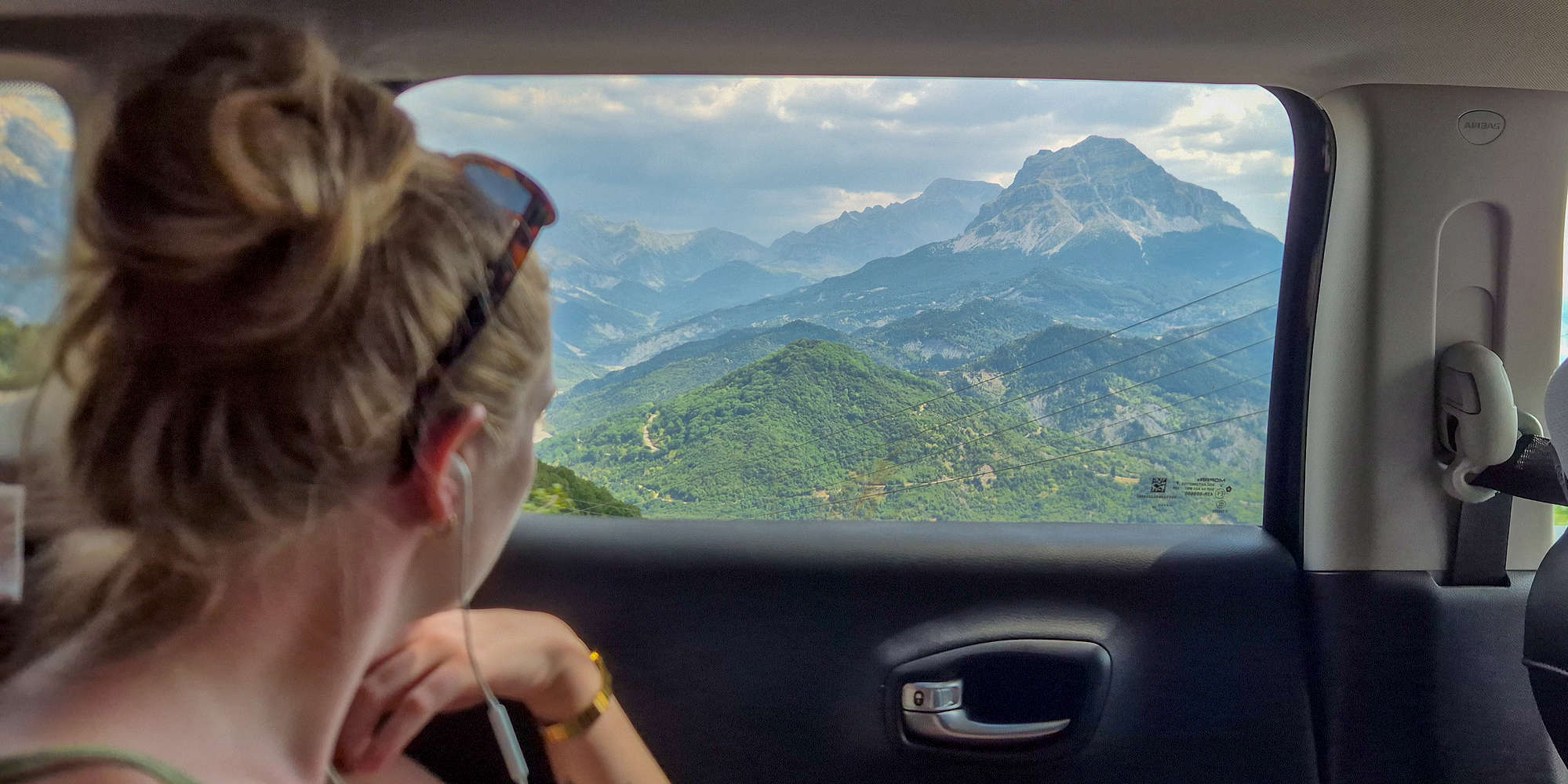
Nieve looking out to Stroggoula (2,112m).
Kouiasas
After driving almost one (1) hour, I recommended we take in the last daylight at Kouiasas (”Κουιάσας”) waterfalls, a ravine below the village, with year-round flow in which we knew I’d be possible to swim. The 15 minute approach on a good trail (T1) to the watermill went by uncontested, and we all tried to swim in the main pool. Having arrived at around 17:30 we caught the end of the day’s vistors, and were glad to have some quiet.
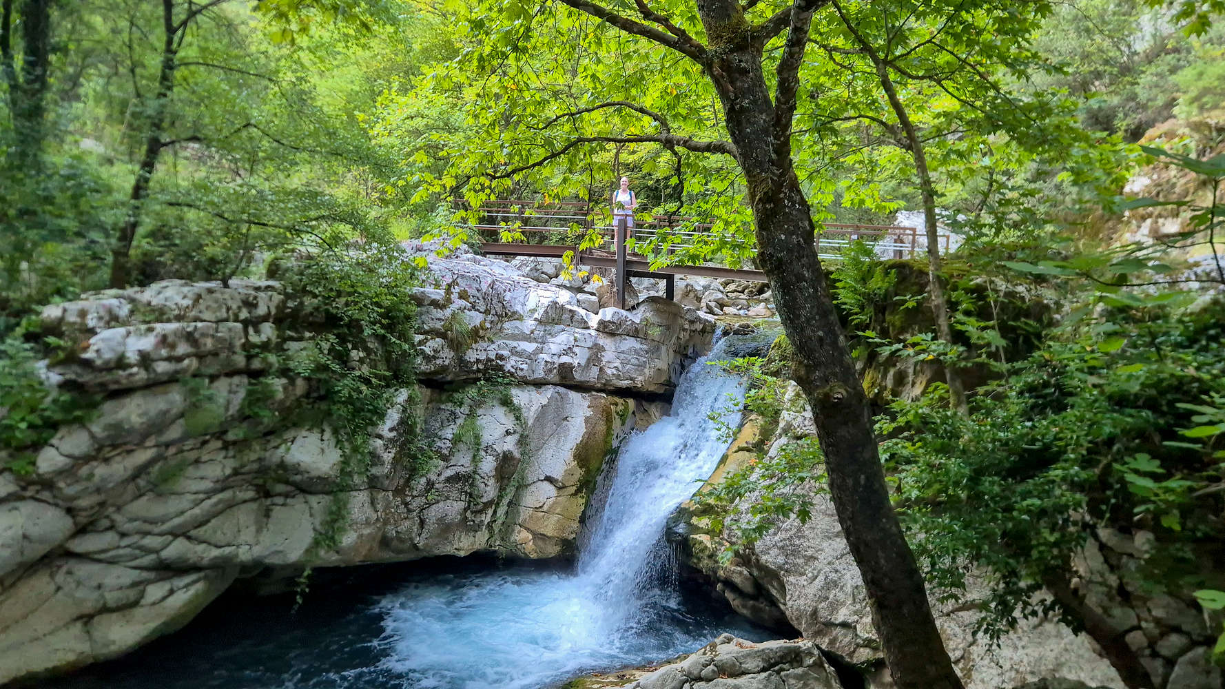
Nieve at the large Kouiasas waterfall.
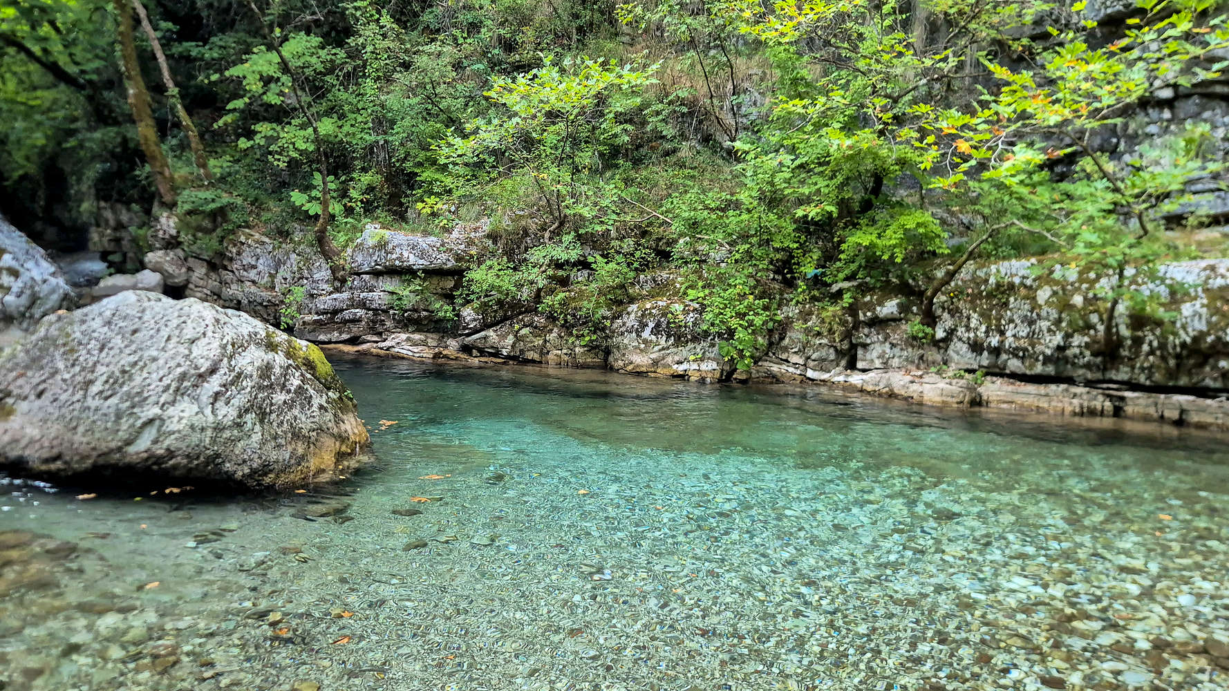
The main ‘ice’ pool at Kouiasas.
The crystal clear waters of Kalarrytikos river, which flow at ~5°C year-round, originate from the large water-table of the Lakmos (2,294m) massif, which extends to the NNE, and are protected under Natura 2000 (GR2130007). By the main pool visitors will find a 19th century water-mill (”ντριστέλας”), whose equipment has been maintained, but which is however, not open to the public. In years prior it was also being operated as a cafe.
Kalarrytes
Kalarrytes (”Καλαρρύτες”) is a traditional stone village built high on the SW slopes of Lakmos (2,294m) into which no cars can pass, and which overlooks the peaks of Tzoumerka (2,429m). Its name means “[the] village of great horse riders”[10] and betrays a past preoccupation of its residents. Most curious is perhaps the history of the village as one of the great centers of silver and gold smithing in the Balkans. In fact, the Aromanian silversmith Sotirios Voulgaris (”Σωτήριος Βούλγαρης”) who moved to Italy in 1880 and went on to found the company Bulgari, traces his roots back to Kalarrytes. This unique history is only amplified by the traditional architecture of the village, which would be connected to the road and electrical networks in the late 1970s.

Afternoon view from Kalarites, Tzoumerka and Kalaritikos Gorge.
After braving the village walk with our heavy bags, and checking into ARCHONTIKO VOGIAROU (⭐4.4, +100) hotel, Nieve joined me for down-time at the village square. With the sun still overhead, we sat down at the patio of Akanthos - Napoléōn Zaglis (⭐4.7, +1000), but found it to be closed an eerily quiet. We must have seem welcoming as first, one of the village’s 14 permanent residents, a man in his 80s, sat down to talk to us, and a bit later a group of adults around our age joined us for a smoke. As time passed and the a golden hue illuminated the peaks across the valley, Napoleon’s son awoke from his siesta to open the restaurant.
Our meal began rather late given how early we had to wake up the next morning. Nonetheless, the food left nothing to be desired, and we ordered one of everything that was available on the day. After our scrumptious dinner, and quite a bit of Tsipouro we got to talking to Napoleon, who updated us on the condition of the access road. We also learnt that the Foot-and-mouth disease (FMD) outbreak led to the culling of up to 30,000 sheep this year, and as a result none of the shepherds went up to their summering pastures. We were ready to sleep just after midnight.
Day 4: Tzoumerka
This day would be the most exhausting of the “approach” part of the trip, as we planned an ascent of Kakarditsa (2,429m), the highest peak of the Tzoumerka range and the 11th tallest in Greece. After the hike we would have some time around Kalarrytes before moving on to Ioannina via a rather difficult road. All in all, we had our work cut out for us.
Kakarditsa (2,429m)
The long snaking forms of the ridges were still hidden in a veil of darkness as we awoke, but with every minute, breath, and step, they lit up a little more, and by the end, under the bright morning sun of a cloudless day in Pindos, we became all the more familiar with them. What does it take to go from strangers to friends?
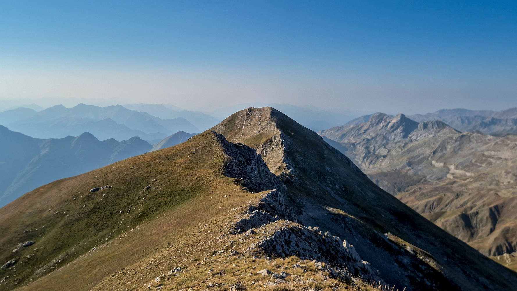
Mbaros Pass
With the summit behind us we continued on the now known-to-be good dirt road back to Kalarrytes. A traffic jam of feral black horses seemed appropriate, and the blue hue of the Thistle strewn slopes complimented the skies. On such a day where it is hard not to appreciate the grandeur of nature we made sure to stop atop Mbaros Pass (1,900m) [”Μπάρος”] if only for photos.
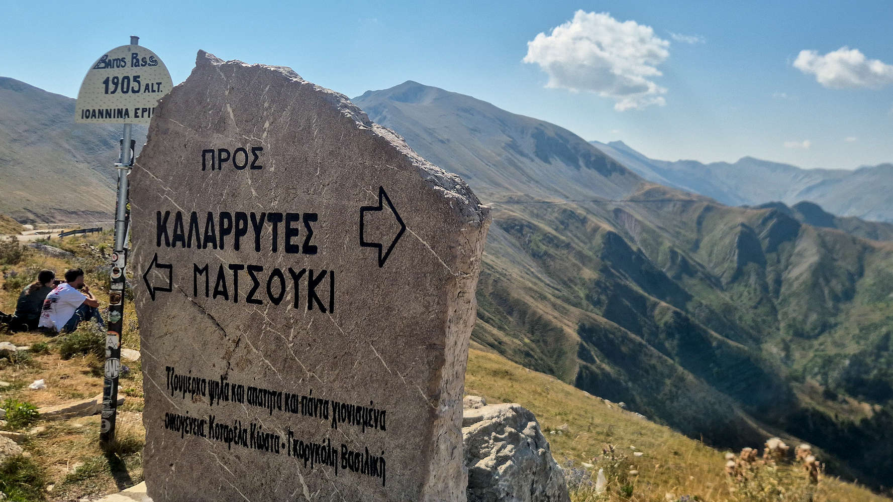
Atop Mbaros (1,900m), Greece’s highest paved road.
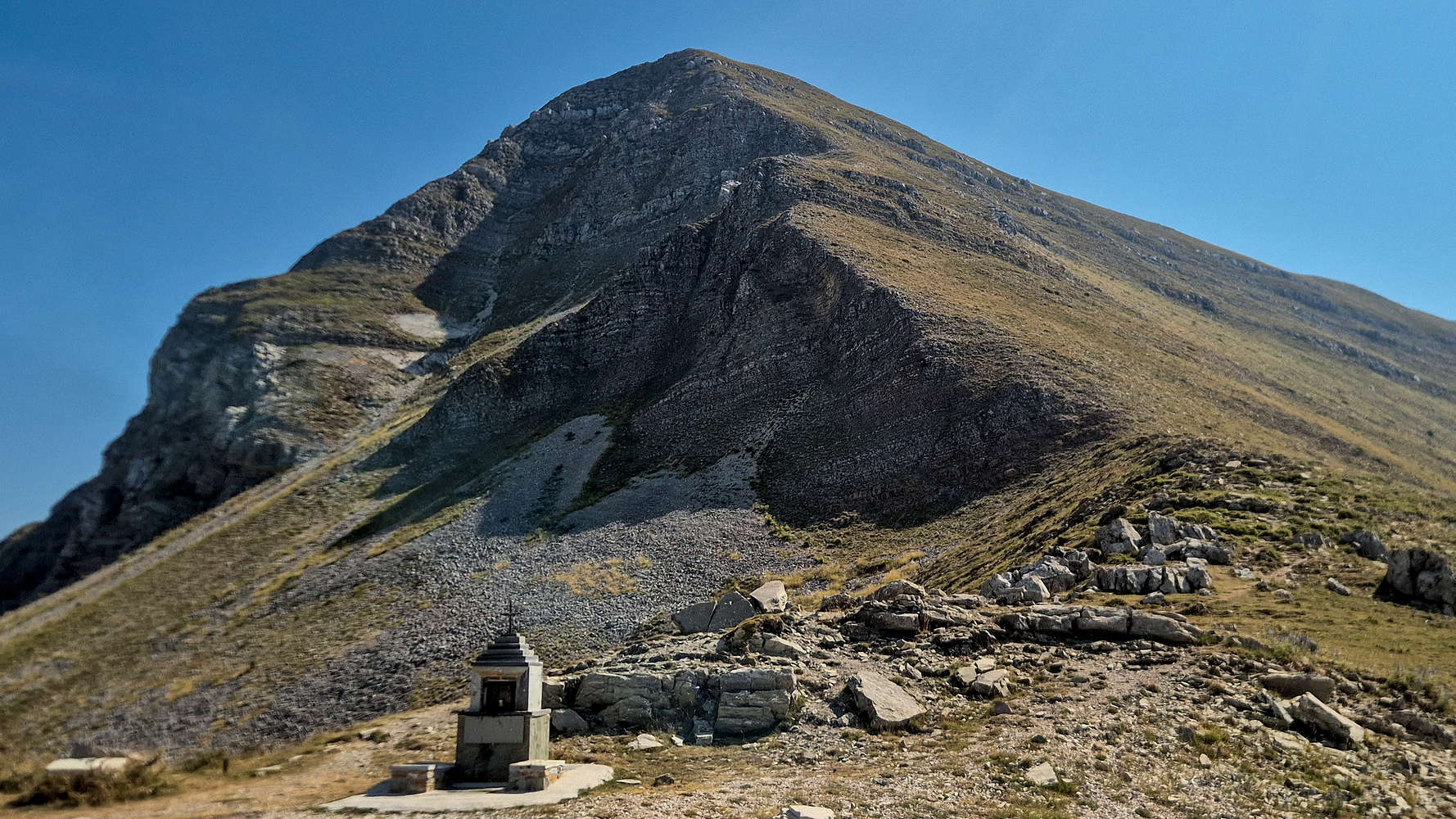
Tsouma Plastari (2,137m); summited in 2023 via the NW ridge.
As usual we stopped at the base of Tsouma Plastari (2,173m), which we had summited in 2023. I always thought it “didn’t look steep”, and that’s why we did it, but clearly that is not the case. We drove back down to the village just in time for our 11:30 check-out.
Breakfast in Kalarrytes
Having packed our bags and cleared our room, I took Nieve for a quick walk to the village square, ending with us once again siting at the patio of Akanthos - Napoléōn Zaglis (⭐4.7, +1000). The village was quiet and with the group uninterested in our planned sight-seeing, we ordered coffees and Spanakopita and took some time to relax.
Kalarrytikos River
Just after noon we left Kalarrytes and drove down-valley to the banks of the Kalarrytikos (”Καλαρρύτικος“) river by the village of Christoi (”Χριστοί”). A small dirt road provides access near the bank, and a short walk leads to the water. We found a comfortable ‘beach’ with enough shade to put our chairs and made the best of the crystal clear waters. The water proved a little warmer than Kouiasas — which feeds into the Kalarrytikos — but only because of the sun.
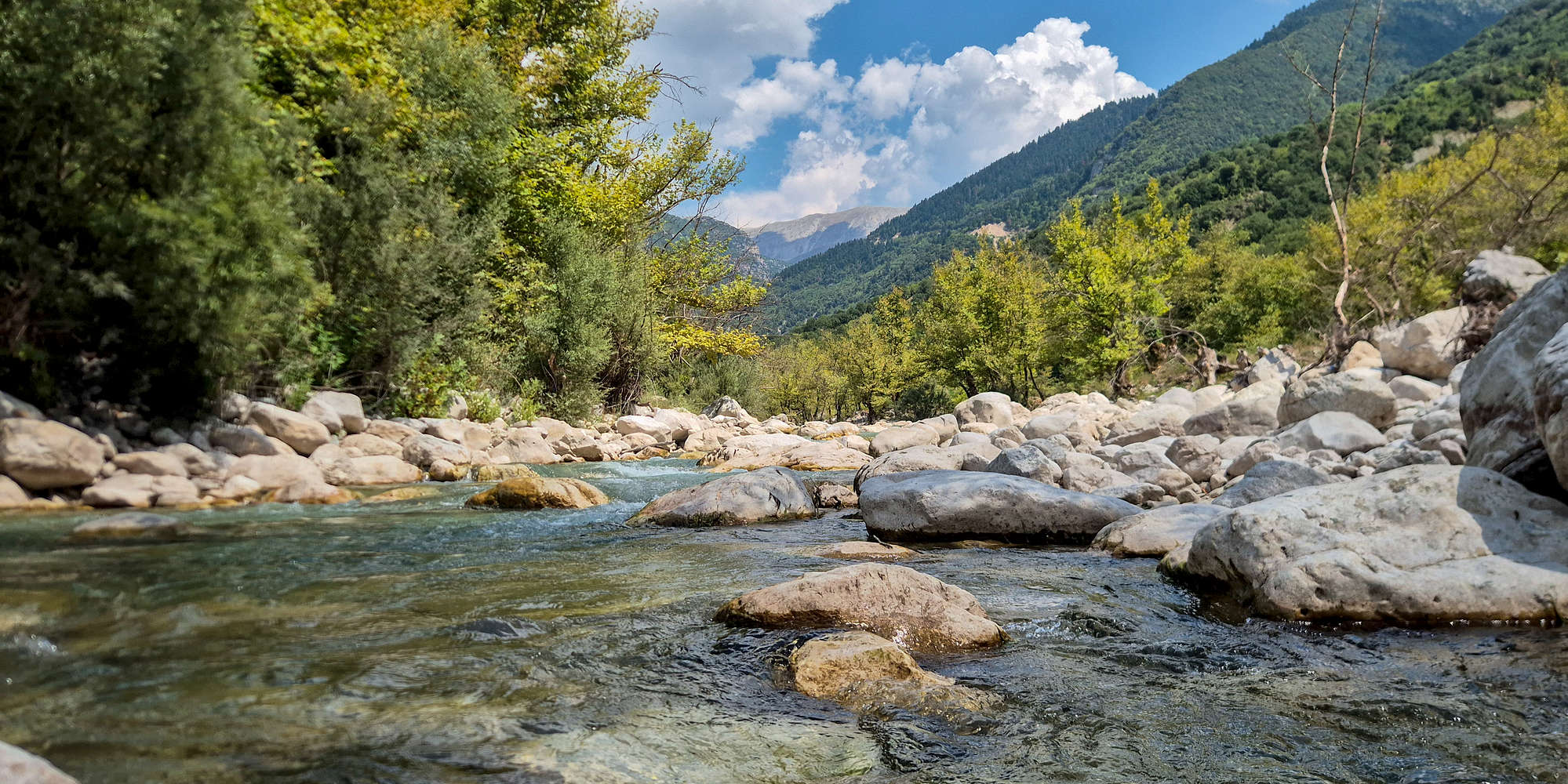
Kalarrytikos river with Tzoumerka behind.
Each of us had their own reason to rest awhile here, especially Terry who had slept poorly. As such, we managed to spend quite a bit of time, and Nieve and I spent it mostly swimming and frolicking in the water. On our last visit in 2024, the range felt a little distant and we only managed a single ascent, yet this time it gave me everything I wanted, and perhaps more. With the clock approaching 15:00, and a long drive ahead to Ioannina (”Ιωάννινα”) we decided it was time to continue onwards.
Drive to Ioannina
From Kalarrytikos we drove onwards to Ioannina through the steep winding old road, and the Tsimovo Pass (”Πέρασμα Τσίμοβου”) one of the most spectacular roads in Greece. However, the afternoon rain caught us out and we were unable to stop and take photos. That being said the surrounding terrain was spectacularly steep and probably worth revisiting. We drove under the rain all the way to our guesthouse, MONTANA Lake View (⭐4.9, +100), in Amfithea (”Αμφιθέα”) across the lake from Ioannina Island, for it to stop just as we took our suitcases out of the car. With eveything being quite far away from the village, we decided to nap.
Ioannina Old Town
After our well deserved nap it was time to set out again, this time into the city. Yet again we were right on time to catch the sunset over the lake. We walked across the old town promenade, in full view of Lake Pamvotida (”Λίμνη Παμβώτιδα”) which although rather polluted, is still recognized as an important wetland (GR2130005) and gave us a pleasant opportunity for some birding. The procession of Great Crested Grebes (Podiceps cristatus) and Jackdraws (Coloeus monedula) was surprisingly disrupted by a large Kestrel (Falco tinnunculus) making a powerful display right above us. Finishing our walk along the walls of the late-Ottoman city, we made our way into the old town.

Sunset above Ioannina Lake. Mitsikeli (1,810m) behind.
The quiet cobbled streets were empty at this time, and we wondered rather aimlessly. Having met Terry and Aris at the gate we entered through, we agreed to meet them at a restaurant, with each of us taking their own course and pace. My walk with Nieve took us through the narrow lanes, among houses of a different era, and plentiful cats. In the end we even found a store with handmade postcards where we got a really nice one for our wall. After 20 minutes we reached Metsovitiki Folia (⭐ 4.8, +10,000) where we enjoyed a well earned spread of excellent Kokoretsi (”Κοκορέτσι”) and finished off our evening with some sheep milk ice-cream from nearby Mpoumpas dairy & frozen yogurt (⭐ 5.0, +50). We called it a night as the August night picked up in Ioannina, but the comfort of a nice bed was too hard to resist. By midnight we were all fast asleep.
Day 5: Vikos
With us on track with our pre-planned schedule since the day before, there was little worry we could pull off this last travel day in good style, after all we had to be in Prespes (”Πρέσπες”) by that night. The itinerary took us from a view point above the spectacular Vikos Gorge to climbing and swimming in its river, before driving the long and scenic route to Kastoria.
Vikos Gorge
The winding roads which are a mainstay of Zagorochoria as much as Vikos, led us up the steep karstic tables on the SW, towards the village of Monodentri (”Μονοδέντρι”). From here, we continued past the it, and followed the road through the Stouros (”Στούρος”) elevated plateau to its edge; 700m above the waters of Voidomatis (”Βοϊδομάτης”) and in front of us, on of the country’s greatest views. Vikos Gorge (”Φαράγγι Βίκου“) is one of the world’s ‘steepest’ gorges with a maximum depth of 1,350m, and a minimum width of just a few meters, and its 32km length makes it one of the most important ecosystems of Europe. It is recognized as such, being part of the Vikos - Aoos National Park, the associated UNESCO Geopark, and a distinct Natura 2000 zone (GR2130009). The gorge offers a special window into the Pindos landscape, with over 200ma of geological history; from Jurassic dolomite to the effects of glaciation during the LGM about 20,000 years ago[11].
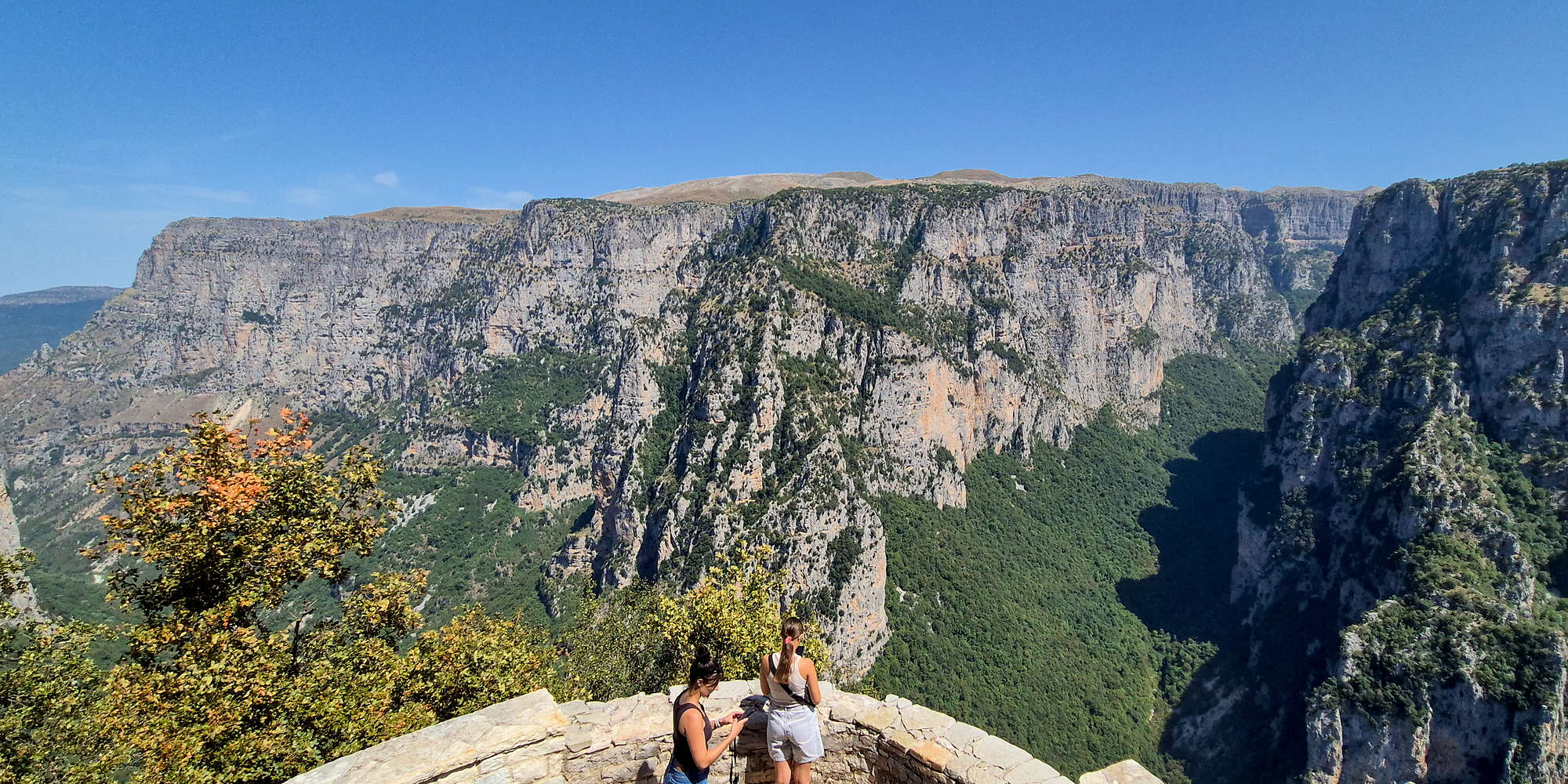
Panoramic view of Vikos Gorge from Oxya.
The viewpoint at Oxya (”Οξυά”) is accessible via an asphalt road and a short 5 minute hike on a good stone path (T1-); with it being Geopark site #26, we expected no less. The platform provides an excellent view into the central section of Vikos, with the scale being very difficult to comprehend. Doubly so having walked across it in 2017 and having the opposite experience, one of claustrophobia, and darkness. I sat on a rock outcrop above with Nieve while Aris & Terry followed a trail W, and we had spent around 30 minutes leisurely taking in the grandiose scenery before they returned. We took some “couples” photos and went on our way.
Stone Forest
On the road between Oxya and Monodentri lies Geopark site #33, the “Stone Forest”. This is an area of the Stouros plateau which features tower-like outcrops of Platy limestone among the trees formed by ice-fracturing over thousands of years. We stopped at the main formation where the tourist information board is located, and having extra some time, Nieve and I climbed it.

Nieve on the traverse (I), with Terry in the low chimney (I+).

”Tourist Route” topo, as seen from the parking.
The “Tourist Route” (I+, 12m) tackles the main tower through the line of least resistance formed by its main chimney(s), but requires some very easy traversing. Highlight of the route is the opportunity to climb on the down sloping platy limestone slabs.
Scramble into the lower chimney (T3), and find the narrower chimney to your right. Climb it and gain the rightmost pillar (I+). Bridge the chimney (I), and climb up the pillar in-front through easy steps (I) to a ledge. Traverse left, bridging onto the main pillar and the larger ledge (I). Continue in a slight right arc through the bulge of strata (I+) on the main face, and top-out. Downclimb or walk off around the back.
Voidomatis Crag
From the Stone Forest, we drove the little-trafficked mountain road towards Kleidonia (”Κλειδωνιά”), where we would make a climbing and swimming stop on the banks of Voidomatis. The drive presented us with postcard views of the Towers of Papigko (”Πύργοι Πάπιγκου”), and after a quick hour we were parked right by the arched bridge. A short walk along the bank brought us to the main sector of the Voidomatis Crag. The setting is especially pleasant for hot summer days with the narrow gorge and tall trees providing ample shade.

High on #1.

At the exit of #2.
We started the session with #1 (5b+, 14m), following the rightmost shallow chimney into a run-out slab to the anchors. Although the chimney is obvious, the excellent fist and hand sized cracks, the airy positions, and the questionable rock quality are what make it rather memorable. We followed it up with #2 (6a, 12m), which after balancing on a glass-smooth slab, takes a line of powerful jugs and down-sloping feet through the main bulge, requiring power and pacing. Even in the shade the heat was excruciating, and that felt like enough for the day. The climbing had taken some time, so I was the last one to dip into the frigid waters of Voidomatis.
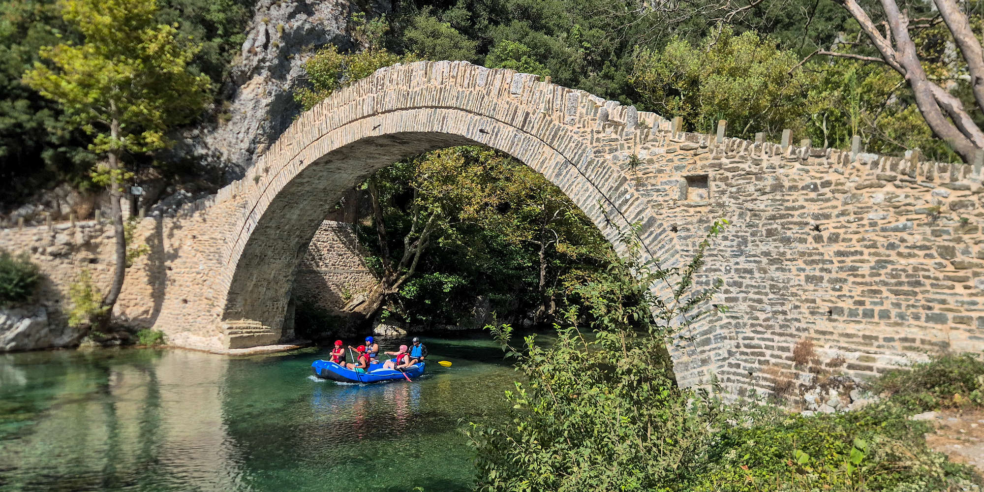
Rafters passing below the bridge.
The Bridge of Kleidoniavista (”Γεφύρι της Κλειδωνιάβιτσας”) was built in 1853 through funds donated by (f.) Balkiz Chanoum to replace an older one which according to tradition was where two feuding families slayed each other during a wedding procession. With the bridge marking the western edge of Vikos, the site has been historically important, with the nearby Mboila Roof (”Βραχοσκεπή Μποϊλα”) acting as a shelter for hunters between 20,000 to 12,000 years ago; during their annual outing for Ibex[12]. Today, marked trails pass through, while visitors enjoy swimming in the river — which run at 4°C year-round. Also quite popular is white water rafting (Class I), passing under the bridge; the most memorable ‘rapid’ (a small dam) is just past it.
Drive to Kastoria
We had to leave Kleidonia at around 16:00, since Aris had to pick up his rental car in Kastoria by 18:30. Our drive via Konitsa (”Κόνιτσα”), offered an incredible view towards the North Ridge of Gkamila (2,497m). Continuing northeast we drove through Sarantaporos (”Σαραντάπορος”) valley, one of the wildest and largest alpine rivers of Greece[13]. Soon enough we were near familiar ground, Kotyli Pass (”Πάσο Κοτύλι”), and Mikra Onteia (1,531m) — which we visited last year. The drive down into Kastoria (”Καστοριά”) went by quickly, and we arrived at the car rental place with time to spare. We took some time to pick up supplies in Kastoria before setting off. We had enjoyed a lush afternoon along Lake Orestiada (”Λίμνη Ορεστιάδα”), a great birding hotspot, and Natura 2000 site (GR1320001) last year, and this time looked forward to a meal and shower in Agios Germanos.

”To Tsekouri” (The Axe), the North Ridge of Gkamila (2,497m).

Deep sea sands somewhere near Kotyli.
Agios Germanos
We were spoiled upon arrival, as we did so under the days dying light perfectly draped on the mountains. We also felt equally welcomed at Hotel Agios Germanos (⭐4.7, +500), by both humans and cats, and after sorting our equipment, went to the square for dinner. Wednesday proved rather quiet so we enjoyed our meal at Prespeion (⭐4.8, +1000) with all the local delicacies that make our visits so appealing.

The village of “German” (Ag. Germanos), 1917.
Agios Germanos (”Άγιος Γερμανός”) is the largest village of the Prespes basin, nestled on the slopes of Varnous (2,334m), and was first inhabited around the 10th Century as betrayed by its Byzantine church. Historically, the village was inhabited by slavophone Macedonians (Brsjaks) and by the interwar period, the village, although prosperous, was not fully assimilated into Greece, and as a result led to its use as a base for the Communist forces (DSE) during the Civil War. The desolation of the village followed, with the residents fearing attacks by the opposing forces, and fleeing to nearby Yugoslavia; however, on July 10 1949[14], the borders would close, leaving many entire communities separated. In the next decades it was resettled by Pontiac and Aromanian (Vlach), Greeks. Today Agios Germanos is a sleepy agricultural village, cut-off from its neighbors to the north, but very much aware of its identity. It is protected under Natura 2000 (GR1340003), and composes Zone B of the Prespes Lakes National Park.
Day 6: Pre-Triethnes
This would be our last “free” day — i.e. without any festival activities. With the heat precluding much hiking, and us admittedly sleeping in, we kept an open mind and instead ended up being rewarded with interesting climbing at a great location, and as usual, new friends.
Wild berries
The day began quietly, and with the sun brightly shining over a cloudless sky, a morning walk was hard to pass up and soon, a small tail-wagging presence would make our acquaintance through a house gate. Stopping to pet him, we meet the owner arriving from what was a successful hike for wild berries. He is only too pleased to offer us two handfuls. The berries are put to good use by Nieve at the hotel breakfast table, I’m was too glutinous and had already eaten mine.

Fresh wild berries.

Nieve & her breakfast toast!
Somehow already feeling full — physically and emotionally — we join Terry to set off for a curious adventure, and follow whispers of a climbing crag on the lakeside. Her sleuthing leads us to the EcoTourismo webpage, and after a couple of phone calls, we have a meeting with Danill P. at the store front at Laimos (”Λαιμός”) village.
Average in height, of slim build, with characteristic reading glasses, a large vape, and messenger bag, Danill made a curious impression. Quickly however, we realized we have common acquaintances with Danill having done much in the way of alpine and traditional climbing, some covered on Routes.gr in his 55-odd years. He was more than happy to provide us with information about the crag, and being the only one with actual permission to climb there, bestowed us his blessings. He had not visited this year, and we were cautioned to perhaps first abseil to inspect the rock; with a “just a scouting trip” in mind, we set off.
To protect the fragile environment climbing is not allowed without permission. To climb at Cape Roti, please get in touch with EcoTourismo.
Metamorfosi Sotiros
It was 13:00 by the time we pulled into the dirt road leading to the Metamorfosi Sotiros (”Μεταμόρφωση του Σωτηρος”) trailhead, and I was quite surprised to be joined by very willing Nieve and Terry on such a hot day. Hauling quite a bit of gear we lost no time in setting off into the low pines which grow abundunt above the lake. The trail was obvious and well signposted (T1), and we soon turned left to continue on the descent to the Monastery — as opposed to continuing straight (N) towards Cape Roti (”Άκρο Ρότι”).

Hiking on the trail to Cape Roti.

THE bench view of Prespes.
Atop the final descent down the lake’s limestone walls — via a steep trail (T3+) — we paused at a bench in the shade of a tree with a spectacular panorama of the glistening blue of the lake, which only seemed too tempting under the hot summer sun. The steep descent proved reasonable even for Nieve, and the overgrown vegetation offered some shade, after 5 minutes we’d reached the bouldery beach. A few hundred meters away we found the wooden stairs which lead up to the Monastery of Metamorfosi Sotiros, and rested in its shade.

View from within the cave-monastery, which is all Albania.
This monastery is part of a larger network of ascetic caves and religious sites strewn throughout the lakes and utilized extensively starting from the 14th century. The remote location of the basin provided refuge for monks who lived at these sites. Among them, a few stand out, and we have had the opportunity to visit them many times; others can be seen here, on our visit in 2025.
Cape Roti Slab
As Nieve and Terry enjoyed a swim in the lake, I went on a pilgrimage for some climbable rock. After quite a bit of thought, and a nagging urge to lead climb, I selected an “easy looking and well bolted” (me) slab. The sun was high in the sky and the slick limestone radiated heat as we roped up.

Not really a common sign to see.

Nieve having a swim from the trail.
“Cape Roti Slab” (5c+ A1, 20m) quickly proved a challenge, with balancing moves on edges and smears to the first two bolts. Soon I reached for some hollow flakes, I drummed on them and dared not think what would happen if I fell, as the bolts didn’t look trustworthy either. After some easy ground, I reached the final slab. Clipping into the crux bolt, I spotted two thin finger cracks, quite overgrown. I spent some time cleaning them, Terry yelling up at me to stop dropping dirt on her. I went on, and once done tried the move a few times with no success (~6b). Drenched in sweat I aided up by carefully pulling on the quickdraw. Atop, the rusted out anchor was the last thing I wanted to see, but decided to trust it anyway with precaution, and in fact, it held a normal lower!

A world class view; almost all of it is in Albania!
Feeling well toasted from climbing the sunbaked slab, I swam into the lake only to slice my foot quite badly, putting a rest to any further climbing plans for the days ahead. We relaxed in the cave before making the hike back out to the car, in an impressive 15 minutes. Only a few tour boats distracted us, a little while I climbed, but also while I changed…
Relaxing in Ag. Germanos
Having already taken in quite a bit of the ambiance of Prespes, and spending our fair share of time in the core of the National Park (GR1340001) we made our way back to the village for some more rest. Terry & Aris’s friends had arrived, and we gave our welcome. Around sunset, we headed into the square and enjoyed fresh cut tomatoes, Florina peppers, and home-made cheese along with our Tsipouro at an unnamed cafe. Later we moved onto To Tzaki (⭐4.7, +200), where Danill joined us, and so did his friend, local, who is the local postman, a hotelier, a farmer, a hiking guide, and musician, Sotiris-Theofilos. We undefinable quantities of excellent food, and drank too much Tsipouro, spending much of the night talking about local history.
We even kept the night going with a drinks visit to O Lele (⭐4.9, 100) for some great cocktails!
Day 7: Triethnes Day I
This would be the first day of the Triethnes festival, and the reason we travelled to Prespes. Our plans would be bound by its busy schedule, and there would be no possibility for dawn-patrol activities, with the first concert at 10:00, an hour away from Ag. Germanos.
NOMAD Prespa at Moschochori
Barely keeping awake from our first night of local culture we were already on the road by 08:30, and by 09:45 were at the unnamed dirt road which leads to the abandoned settlement of Moschochori (”Μοσχοχώρι”). Just 300m from the Greek-Albanian border in the spectacular valley of Vatochori (”Βατοχώρι”), between Triklario (1,776m) and Boutsi (1,785m) all protected by Zone B of the NP (GR1340010), Krypoigi was abandoned in the 1950s, and today only ruins of its church stand.

The ruins of Saint Dimitrios in Moschohori.
Within those ruins percussionist Panagiotis Ziavras and performer Myrgon went on to perform their mystical ‘ritual’ with the soft sounds of bells and the smells of incense. It was similar to the performance of the year prior. The aesthetics of the church were unrivalled, and I took the time to lay on the grass half drifting to sleep.
Agios Achillios (935m)
Following the concert, we were sent on worker-crew duty at Agios Achillios Island, and did so obligingly. I took the time to run to the island’s highpoint while the rest of the gang had a light lunch.
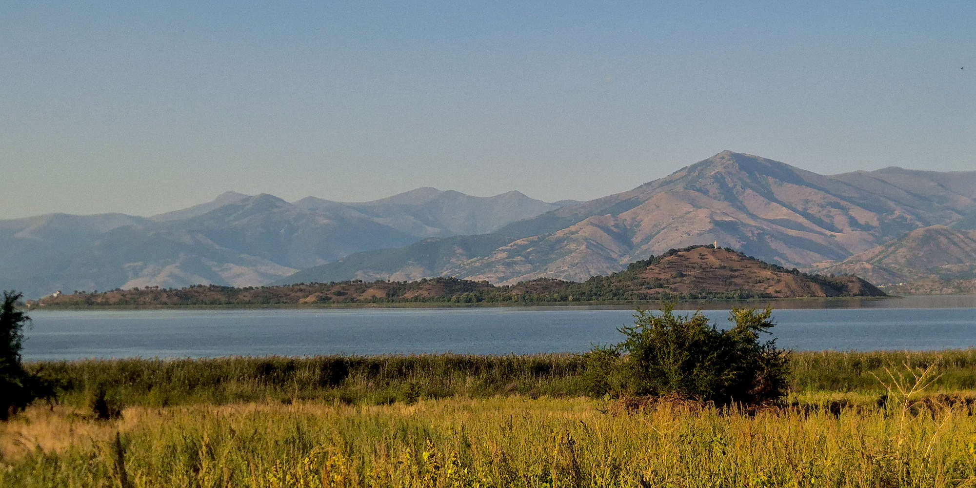
Leaving the island we were at least pleasantly surprised by a Squacco Heron (Ardeola ralloides), one of the few types of Heron in Greece which I had not yet spotted.
Këngë Djepi at Daseri
Distraught by the day’s heat we found some time in Agios Germanos irresistable, after all we had to go to the abandoned village of Daseri (”Δασερή”) for the first of the evening’s concerts at 19:00. With a long dirt road drive ahead, we left by 17:30, and arrived at the midge-filled parking lot, where vans took us the final kilometer or so to the actual village. We took in the glorious sunset which had just began.

The SW face of Dikorfo (2,113m) above Little Prespa.

Near moon rises above Mikrolimni.
Daseri is one of the many villages which were left abandoned following the Civil War, and today only the ruins of the school remain, and of those not much either. The concert featured a small musical ensemble — cello and electronics — which entered into dialogue with vocal traditions, lullabies in Albanian, Greek, and Slavomacedonian, performed by Natasa Tsakiridou in conversation with soprano Marianna Nomikou. The lullabies were quite successful in helping me slowly drift to sleep as another glorious sunset unraveled, the dim glow of the moon slowly taking over the basin.
Paulo Álvares & Vlach Polyphony at Psarades
There would be no rest for the wicked however, as by 21:00 the next concert at the village of Psarades (”Ψαράδες”) would begin. Like most of the festival attendants we drove straight there. Yet again we had time to spare, and I joined Nieve in buying sodas and snacks, as well as chilling during the concert-start delays. Alas by 21:30 we were sat in the second row at the square of Psarades, with many others in attendance. It was great to see such reception.
For this concert pianist Paulo Álvares, considered one of the most important interpreters of contemporary music over the past fifty years, created an improvisational palimpsest in continuous dialogue with a Vlach polyphonic ensemble traveling especially from Drenovë Albania to meet him at Psarades Square.
Following the concert we had dinner at Tavern Akrolimnia - Lazarοs (⭐4.8, +250) but not before taking a walk across the floating platforms, taking in the quiet of the night. Yet again we enjoyed exceptional local food, alongside plenty of Tsipouro.
Day 8: Triethnes Day II
With us being somewhat tired from all the events, and the manual labor of the day before, our second festival day we decided would be one of abject relaxation. After all, there was only one event planned, and the temperatures stayed very high all day, precluding doing much else.
Laimos Beach
Thus, following a late sleep-in, we drove to the village shop for drinks and snacks before making the 10 minute drive down to the lake-shore, and beach! Familiar with the area from the year before, we found a cool & shaded spot to put our chairs and table, and enjoyed the peace and quiet. Terry joined us for a bit, and enjoyed the novelty of the shallow lake water near the shore, the swimming more akin to a pleasant bath.

Nieve enjoying the beach.

View of Laimos Beach from the Stara river delta.
We relaxed in the shade and intermittently swam, bathed, and walked in the lake, providing just enough protection and refreshment to beat the day’s heat. Seemingly all alone, we were also able to birdwatch quite effectively, and we managed to spot various birds including: a Gray Heron (Ardea cinerea), Dalmatian Pelican (Pelecanus crispus), and Collared Flycatcher (Ficedula albicollis), among others. By 16:30 we were back on our way to the hotel for a shower.
Around Agios Germanos
With the afternoon bringing in cooler winds, we decided to talk a walk around the village, quickly however escaping the cobbled streets for a small side-trail, which we followed to an Iconostasis on a small ridge. We settled at its base, and in full view of the setting sun I drifted off to sleep; the song of birds and the whisking wind providing the perfect lullaby. Once the sun dipped below the horizon we walked back to the hotel, but not after some birdwatching which yielded a Middle Spotted Woodpecker (Dendrocoptes medius), and a Common Redstart (Phoenicurus phoenicurus).
Pierrot Lunaire
Our nights entertainment would be led by Giorgos Iatrou in the role of Pierrot in the melodrama Pierrot Lunaire Op. 21, otherwise known as “Pierrot in the Moonlight”. The play took place at the Agios Germanos Byzantine Collection, and was synced, both date & time, to the rise of the full moon above the building; providing the audience with a unique experience. Although a complex play, especially for the audience, it saw great acclaim, due in part to the great work of G. Iatrou, the ensemble, the production, and of course, the setting itself.

G. Iatrou playing Pierrot, under the moonlight in Ag. Germanos.
Pierrot Lunaire Op. 21, is a melodrama by Austrian-American composer Arnold Schoenberg based on translated works of Belgian poet Albert Giraud. Originally premiering to mixed reception in 1912, it is one of Schoenberg’s most popular works. Its protagonist, Pierrot, a stock character of 17th century commedia dell'arte had been associated with the disenfranchised, and the poems deal with themes of psychological fragmentation, disillusionment, and alienation of the modern artist. Interestingly, it utilizes the Sprechgesang (speak-sing) style which does not sustain pitches, and therefore associates the mood of the speaker to that of the music.
Day 9: Triethnes Day III
With the end of the festival close approaching, we still had not finished our planned tasks around Prespes and looked forward to another couple of days of adventures. For Saturday, we were mainly interested in doing a final outdoor activity, this time with Danill — who was so helpful — before making our way to the headline event of the festival.
Kayaking on Little Prespa
Albeit a little late to our discussed meeting by over an hour, the cooler day meant that by 11:00 we were feeling keen to explore the lake. After Danill joined us, we drove to the base of the promenade and equipped our kayaks for the excursion. The conditions were helpful for birdwatching, but the season had seemingly ended and there were few to be seen.

Nieve kayaking on Little Prespa lake.
Instead, as we paddled out to the reeds, slowly realizing that we forgot our water, we were surprised to see a couple of Eurasian Otters (Lutra lutra), passing embraced between our kayaks. We then followed Danill, first to Agios Achillios Island, where he told us all about its history, and then towards the Pelican colonies. Staying in the allowed zone, there was little to be seen so late in summer, although some Mute Swans (Cygnus olor) and Graylag Geese (Anser anser) were a rewarding spot. After nearly 2 hours, and rather tired from the effort, heat, and lack of water, we returned to land.
Experience Little Prespa and its wildlife from up close with the EcoTourismo Kayaking Tours.
Laimos Beach
Clearly not having had enough of water-based activities for the day, we left Terry in Agios Germanos and drove down to the beach for another lazy day. We didn’t do much besides chill, swim, and birdwatch, with the latter proving to be one of the best sessions of the trip. Highlights of our stay included a Great Egret (Ardea alba) and Common Nightingale (Luscinia megarhynchos). However, with it being a Saturday, the beach was slightly busier with a couple of families. By the late afternoon we headed back to our hotel to change and head to the night’s concert.
FOUR SEASONS / Perpetuum mobile
As usual, Saturday night marks the main event of the festival, which would be hosted at Mikrolimni (”Μικρολίμνη”) quarry following its success as a test location the year prior. The setting, offers a unique combination of incredible natural acoustics with an unrivalled sunset view, and this year the minister of culture Lina Mendoni would be in attendance. The play adapted Max Richter’s vision for Antonio Vivaldi’s “The Four Seasons”, for strings, harpsichord, harp, and solo violin, with a physical performance, directed by Panos Zygouros, unfolding between the seasons and entering into dialogue with the traditions of Prespes: its daily life, its activities, and the interactions that shape existence around the lake. In simple terms, the four seasons of life at Prespa Basin.

The local theater troupe, and the sounds of Vivaldi, along with the best sunset in Prespes.
The involvement of the local theater troupe, but also the music, and themes seem to have struck a cord with the local audience who loved the production, which in turn seemingly unraveled into a veneration of the seasons, which truly rule life in Prespes, with the quintessential backdrop of the summers-end. I can think of no better way to herald the beginning of Autumn. As for me, I found myself deeply moved by the scene, and found it hard to leave my photography perch even after the sun had set and the music ceased.
Grills & Campers
As we had waited for the event to begin that evening, our walk would have us run into a group of local fishermen/hunters who were camping on the beach below the quarry that weekend. They knew about the event, and its townie crowd and were quite eager to invite us for a beer. We sat at their table and chatted, they seemed to enjoy our company and asked us to join them later; there would be grilled meats!
After the concert, and true to our word, we made the walk down to the beach as everyone else headed into the village for dinner. They were quick to arm us with both cold beers and a plate of food, and Nieve had her first taste of ribs (sheep or lamb), which she loved. We spent a few hours chatting, which devolved into laughter with Nieve stealing the show in her drunken Greek, which the fellas tried to match with their own drunken English. Their friendly dogs, campfire, and booming laughter radiated an honest hominess, and at some point they event played host for a local police officer who joined for a beer and smoke. They could not have treated us any better, and we were quite sad to go our separate ways after a few hours; and insistent calls from Aris & Terry over at the taverna.
Mikrolimni Feast
Our walk brought us closer not only to the tavern “Στου Χάσου” (⭐4.8, +500) but also the buoyant sounds of bronze musical instruments (”χάλκινα”). It seemed as though we walked right into a glenti (”γλέντι”), meaning “feast”, and one that occurred completely naturally as the elation of the success of the play got the local musicians — who are part of the troupe — to simply break out in concert. With the Tsipouro flowing, and the delicious food consumed, it was easy to join the dancing, and I did so with both Danill & Jason, even having Nieve join at one point. It must be noted that leading the musical festivities was our friend Sotiris-Theofilos, and this was not lost on us and we danced to his melodies.
Day 10: Triethnes Day IV
After four days of drinking, sun, and festival events, we to some extent looked forward to it all being concluded. This was somewhat obvious on Sunday morning which found us hungover and tired. However, we would not let another great day go to waste, and were determined to stay energized through to the closing event, which would feature a techno DJ.
Laimos Beach
Suffering from the consequences of alcohol we left Agios Germanos rather late, and after a visit to the shop, made our way back to our spot at the beach. The heat had somewhat returned, along with an impenetrable haze which gave the surprisingly still lake an out-worldly ambiance. We did more of the same, but made sure to spend a lot more time in the water; after all we would be back in drab Athens, and our life precluding bodies of water.

Nieve walking along the still Great Prespa; Golem Grad in the distance.
The quiet Sunday proved exceptional for birdwatching, and over the 3.5 hours we spent there, managed to record 15 species. Highlights include many species already seen and mentioned, but also a Black-headed Gull (Chroicocephalus ridibundus), a Great Reed Warbler (Acrocephalus arundinaceus), a Lesser Whitethroat (Curruca curruca), numerous Great Cormorants (Phalacrocorax carbo), and even a giant Long-Legged Buzzard (Buteo rufinus).
Birding Walk
Later in the evening we joined Terry for the “2nd PRESPENSIS in Concert” student event, at the Pelekanos bean-cannery, however, having just eaten a large, and excellent, pizza from Tavern-Pizzaria “Oi Anamniseis” (⭐4.6, +10), we were more keen to go for a sunset walk rather than sit indoors and listen to contemporary compositions. As such, we set off behind the cannery.

Wild sour apples on our walk near Laimos.
Following an arrangement of dirt roads in search of the song of birds, we didn’t initially find much. Instead, it was the beautiful sunset, the lush groves of beans, the wild apple-trees, and the cool dusk air which reminded us how precious it is to be out here. In our search, we oft find the truth. But alas some birds did make our acquaintance, among them another Middle Spotted Woodpecker (Dendrocoptes medius), but also a Eurasian Hobby (Falco subbuteo). After an hour, we returned to Pelekanos.
Closing Panigyri
Sunday would be the last day of the festival, with the main event being the Closing Panigyri — a communal celebration, usually on saints days. The old packaging house was transformed into an explosive space of celebration and collective musical experience, moving to the rhythms of a traditional village feast with the participation of the band “Aidonia tis Florinas”; traditional Balkan sounds meet techno and Balkan beats in a hybrid musical set curated by Athens-based music producer Fofi Tsesmeli – DJ Fo. Needless to say we enjoyed ourselves with plenty of beers and in good company, putting a lovely end to our trip.
Day 11: Return to Athens
Monday dawned and sadly I would have to get back to work, and do so remotely. Therefore, there was very little to do during the day, and I spent most of the morning in the room. I was able to take a briefly sneak away to buy local products as gifts for friends at the shops, and by 13:00 it was time to leave.
New Road
Annie & Nikos, friends of my parents who had joined us in Ag. Germanos for the festival since Thursday volunteered to take us — and some of our things — back to Athens, allowing Aris & Terry to have a more leisurely return over the next few days. Our drive was rather uneventful as we made a straight line back to the city with very little traffic. The only thing notable was using the newly opened section of the A3 Motorway between Grevena (”Γρεβενά”) and Kalabaka (”Καλαμπάκα”). By 19:00 we were back at home in the center and reunited with our cats after 11 days away!
Logistics
The trip was as usual, self planned, with us figuring out a route which would offer us the most new sights and summits on the way to Prespes. Our journey included five (5) full driving days, and thus, five (5) different hotels across Greece. To make the journey we used our trusted Jeep Compass hybrid, which all four (4) of us (i.e. Nieve, Terry, Aris & Myself), all used, including bringing with us two (2) sets of hiking gear, (2) personal climbing kits, and (1) sport climbing kit. Unlike many other trips we had a lower distance driven on dirt roads, mainly on account of less peakbagging.
It must be noted that the actual Day 3 plan we followed deviates significantly from what we had originally planned due to the extreme temperatures.
Socrates Organic Village
Located just outside Messolonghi in the quaint settlement of Agrilia, the small hotel “Socrates Organic Village” (⭐4.7, +250) offers a cool concept, modern rooms, and worthwhile amenities, making it a top choice for a nights rest. The hotel grounds feature a small farm, as well as two (2) pools, one of which is reserved for the bungalows. The rooms are modern, and although only half have balconies all feature spacious bathrooms. The breakfast left a lot to be desired, with very few local and fresh options. Nieve made good use of the pool in the hot morning, so that is a plus.

Rouista Mountain Resort
Nestled at the edge of Vourgareli in the shadow of the high peaks of Central Pindos, “Rouista Mountain Resort” (⭐4.8, +1000) is a luxurious option with a traditional vibe and a modern twist. The rooms are beautiful and very well appointed; the outside areas equally we kept. The hotel features its own restaurant Bostani (⭐4.7, +50) which was very good, although pricy, and the breakfast was good, although still missing some elements of high quality local goods. The hotel does not feature any amenities but is well connected to nearby trails — although mainly downhill.
Archontiko Vogiarou
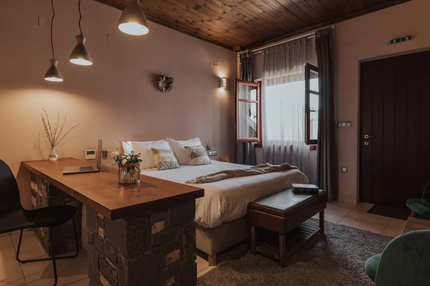
A non-descript large stone-built house, among many in Kalarrytes, “Archontiko Vogiarou” (⭐4.4, +150) is one of the very few options for accommodation in the village. It cannot be described as modern, with the rooms rather cramped, and fitting to the village style (read, small windows). The best description would be spartan, and more akin to the level of hotels we usually encounter on remote mountain villages. That being said, there was a fridge, hot water, and a TV. I did not try the breakfast so cannot comment, but I can say that the overall value is rather poor.

Montana Lake View
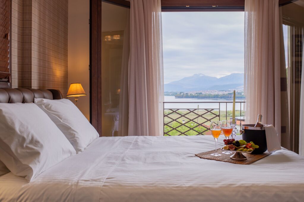
Just a stones throw away from busy Ioannina, Montana Lake View (⭐4.9, +100) is a family-run guesthouse with well, excellent lake views; but that is not all. The brand new complex is very modern but well designed in ways that accentuate the views. The rooms are spacious, modern, and very tasteful, but the bathrooms are on the smaller side. There is also a lovely outdoor area, along with a beautiful kitchen & living-room arrangement. Another benefit of the modern design are the windows which offered great insulation and a very restful night. The breakfast was also quite good, fresh & local.
Hotel Agios Germanos
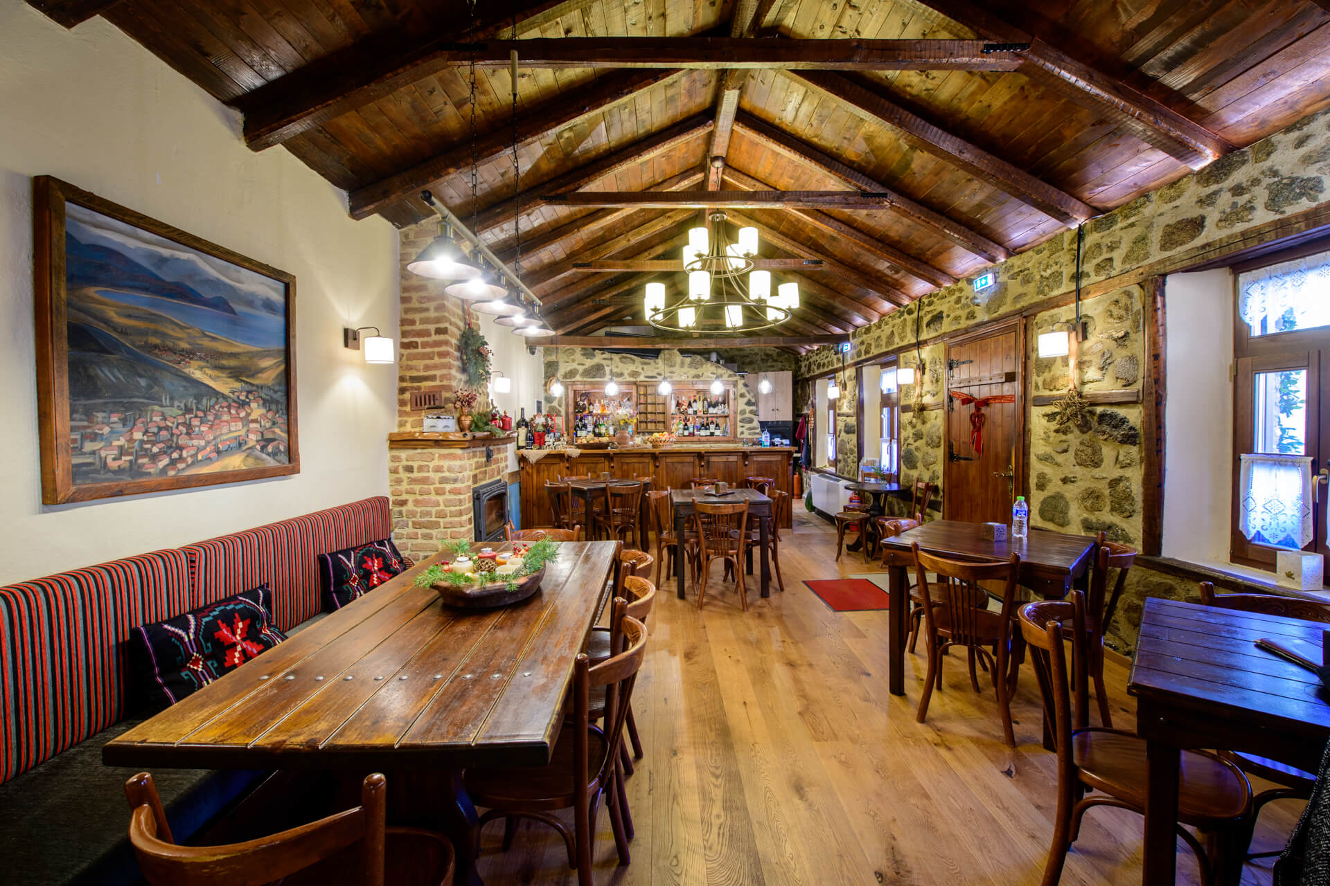
Right in the center of the historic village of Agios Germanos, and a few steps from the shops, tavernas, and bar, is Hotel Agios Germanos (⭐4.7, +500). Spread across a small complex of traditional building centered around lush courtyards, the hotel offers a uniquely relaxing ambiance. The rooms vary in size, but most feature walls and windows better suited to the colder conditions of yesteryear. That being said, the exceptional handmade breakfast will energize visitors enough to easily escape past the quaint grounds, and to any of the hundreds of things available to do in the basin!
Peaks Mentioned
Peaks mentioned in the text or images in descending order of height.
References
Further Reading
References used in the writing of subsidiary texts that are associated with this trip report.