Ymittos (1,026m) [P-792]
Summited On: January 31, 2026
Region: Athens, Attica, Central Greece, Greece.
Overview
Oros Ymittos (1,026m) [P-792] [”Όρος Υμηττός”] is the shortest of the three main mountains which form the Athens Basin, and it delineates the Eastern end of the city, dividing it from the plains of Attica towards Sounion. It rises steeply over Athens over a short distance, making it feel airy and precarious, while its summit is visible from across the city. While it is the most unlikely to see ice or snow, it is popular among hikers and climbers alike.
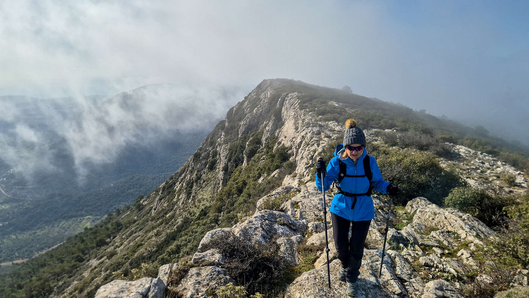
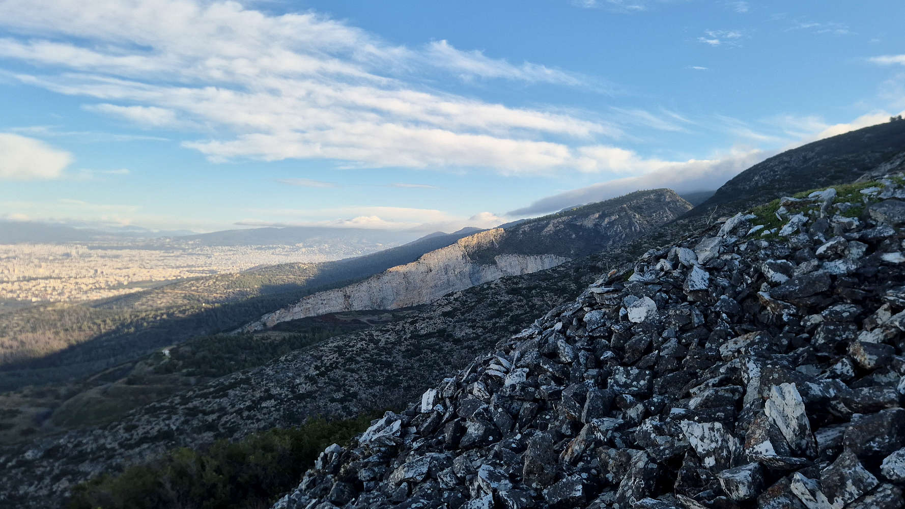
Hiking on the South Ridge of Ymittos.
The summit of Efzonas from the ridge.
Ymittos is greatly associated with Athenian life and it is likely the most popular and busy of the three large Athenian peaks on any given day. However, its network of trails and scattered sights often lead hikers around its base and not up to its summits. The large radar dome which marks the highest point, remains a mystery to most Athenians who are happy enough to see it from 900m below.
Route
For once, I let Terry decide on a destination, an also the route(*), so when I was informed of a loose plan on Thursday I just said that I would join and that was it. Wanting to stay on the theme of “walking more, driving less” Terry opted for Ymittos (1,026m), the friendly giant which stands right above central Athens. She shared a route GPX which I vaguely checked, noting the trailhead as the Monastery of St. John at Kareas. On Friday, I was at the drawing board, and selected - from constrains - a route leading to Ymittos summit, Efzonas (1,026m), via the South Ridge. Very little quality information on the route is available, and I was excited to attempt it, even better, it was the exact route Terry had sent me.
In terms of difficulty the Ymittos South Ridge (T2+, 200m) is significantly easier than Flambouri Ridge (II+, 600m) as well as much less committing. While it may lack verticality, the route is airy and offers great panoramic views across Attica. It can be accessed much more easily by driving up to the base of the telecom towers and isolating the ridge section (+200m), which takes about 30 minutes one way.
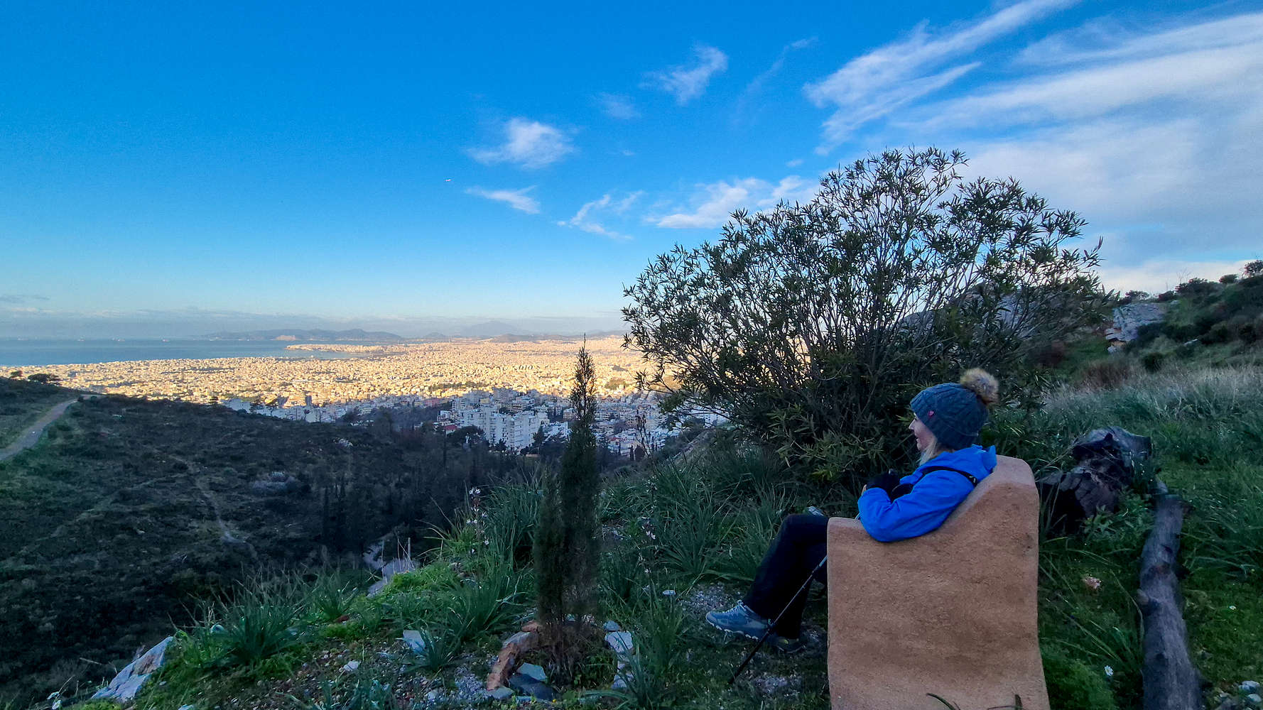
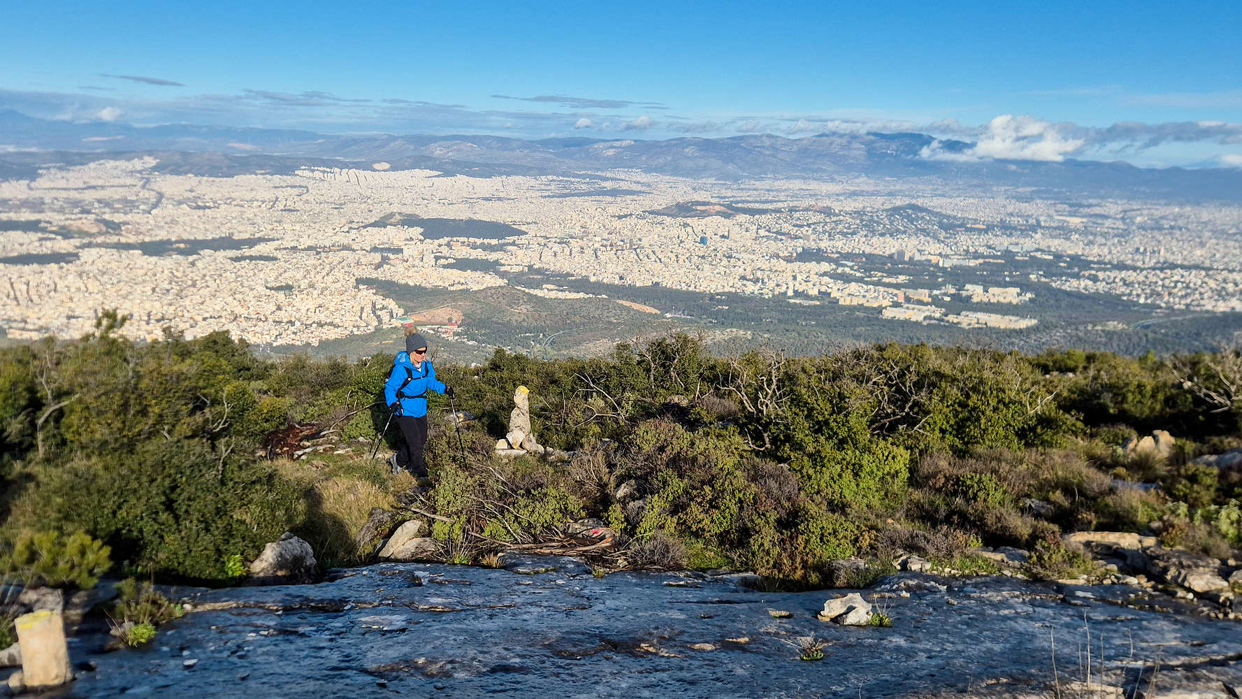
Terry enjoying the view.
Ascending towards Pirgos (814m).
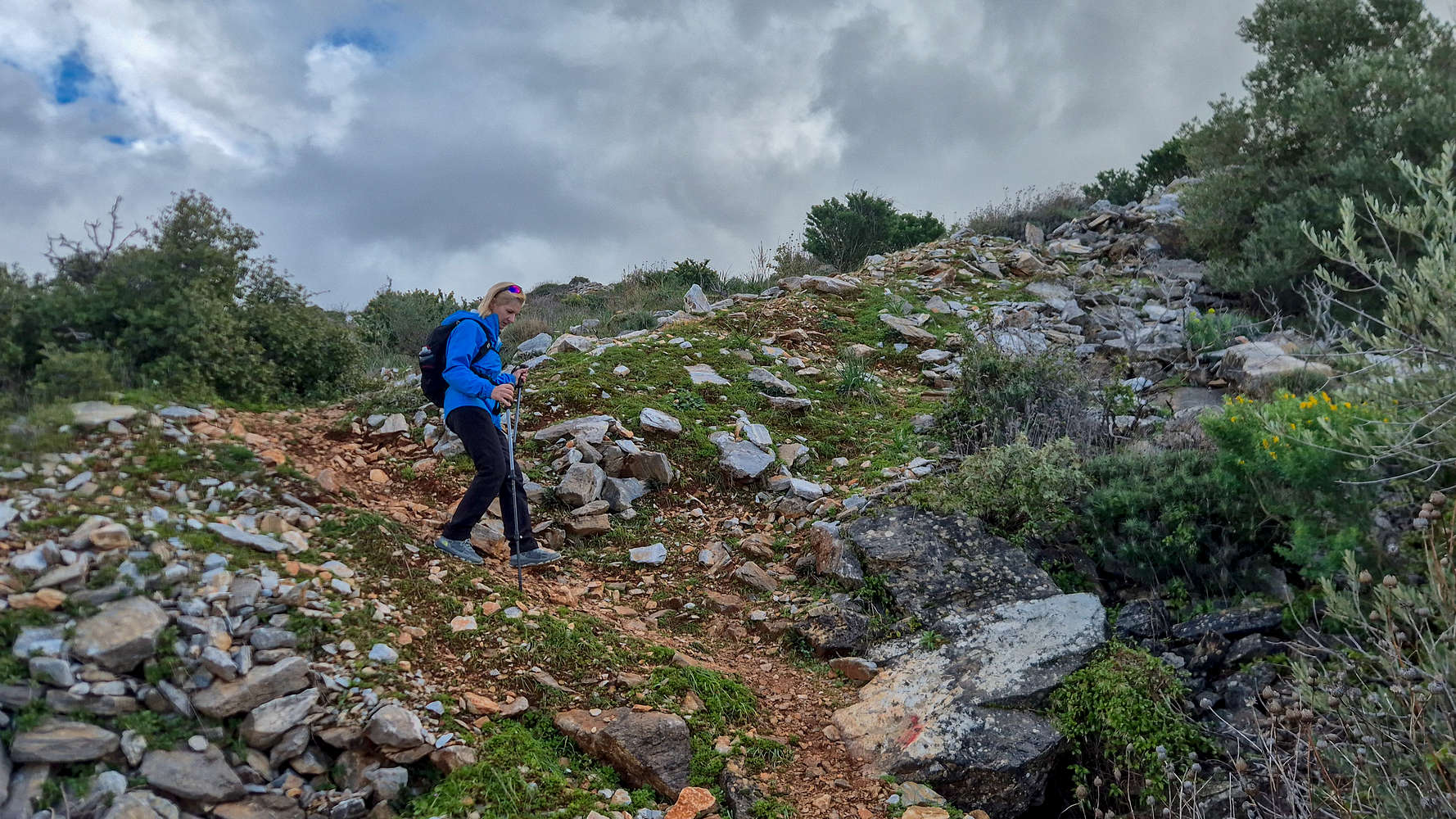
We arrived at the busy parking lot at St. John Monastery at Kareas around 09:00, and quickly became acquainted with the crisp wind of the day, which was rather excruciating in the shade. Luckily, we soon warmed up on the first steep and loose steps used to gain the shoulder above the monastery as we started our hike. Reaching a little ‘balcony’ Terry enjoyed a sit at The Throne before we continued on the loose boulders above (T3). Ascending onto the ridge leading us up to Pirgos (814m), we joined a well marked trail and continued due East. After about 20 minutes we took a left near Drakospito Turia (”Δρακόσπιτο Τυριά”) after a water break, and followed the trail uphill.
View of Kakorema from the ridge.
Navigating the slabs under the sun.
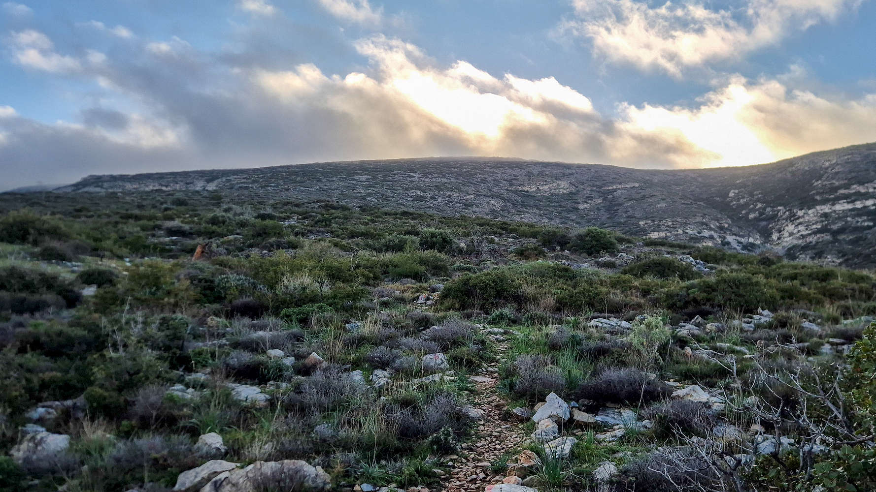
Reaching the plateau of ruins at about 580m after about 40 minutes, we caught our first full views of the quarry scars of Kakorema glistening under the morning sun, soon it would come over us. Throughout this section, the mountain showed its characteristic rough terrain of limestone, either in a near scree form, or as massive wet slabs of insignificant incline (T2). We began running into more of the later as neared the hour mark and slowly navigated through the maze of shrubs and slabs.
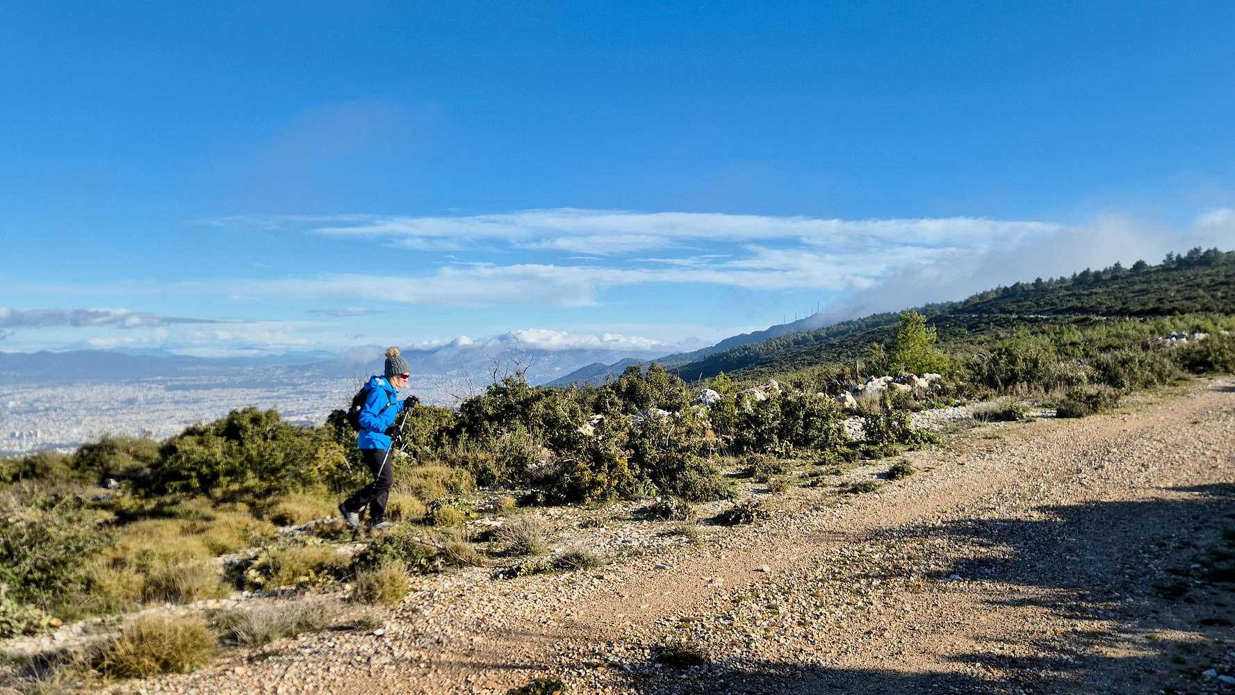
Reaching the Pirgos FSR on Ymittos.

Moving clouds obscure any views.
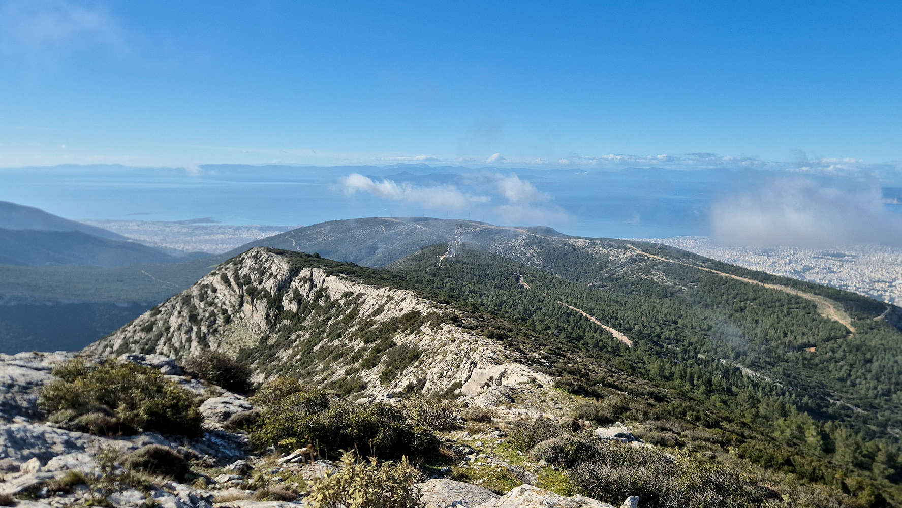
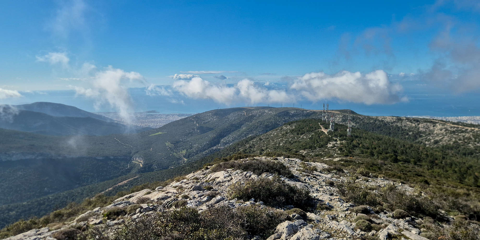
We exited the trail and joined the FSR which traverses along Pirgos (814m) after around 1:10 hours from the trailhead, and broke into the 750m level. We took a couple of minutes before continuing along the road (T1), which should have offered great views of Athens. However, we enjoyed only a brief spell of clear sunny weather as the morning winds began moving in clouds. We walked the long but flat FSR across Pirgos (814m) and towards the base of the summit within a vail of clouds; we had forgotten were we were. We also ran into the first and only people we saw on trail all day, first on the FSR, and then later on the winding road to the telecom. towers.
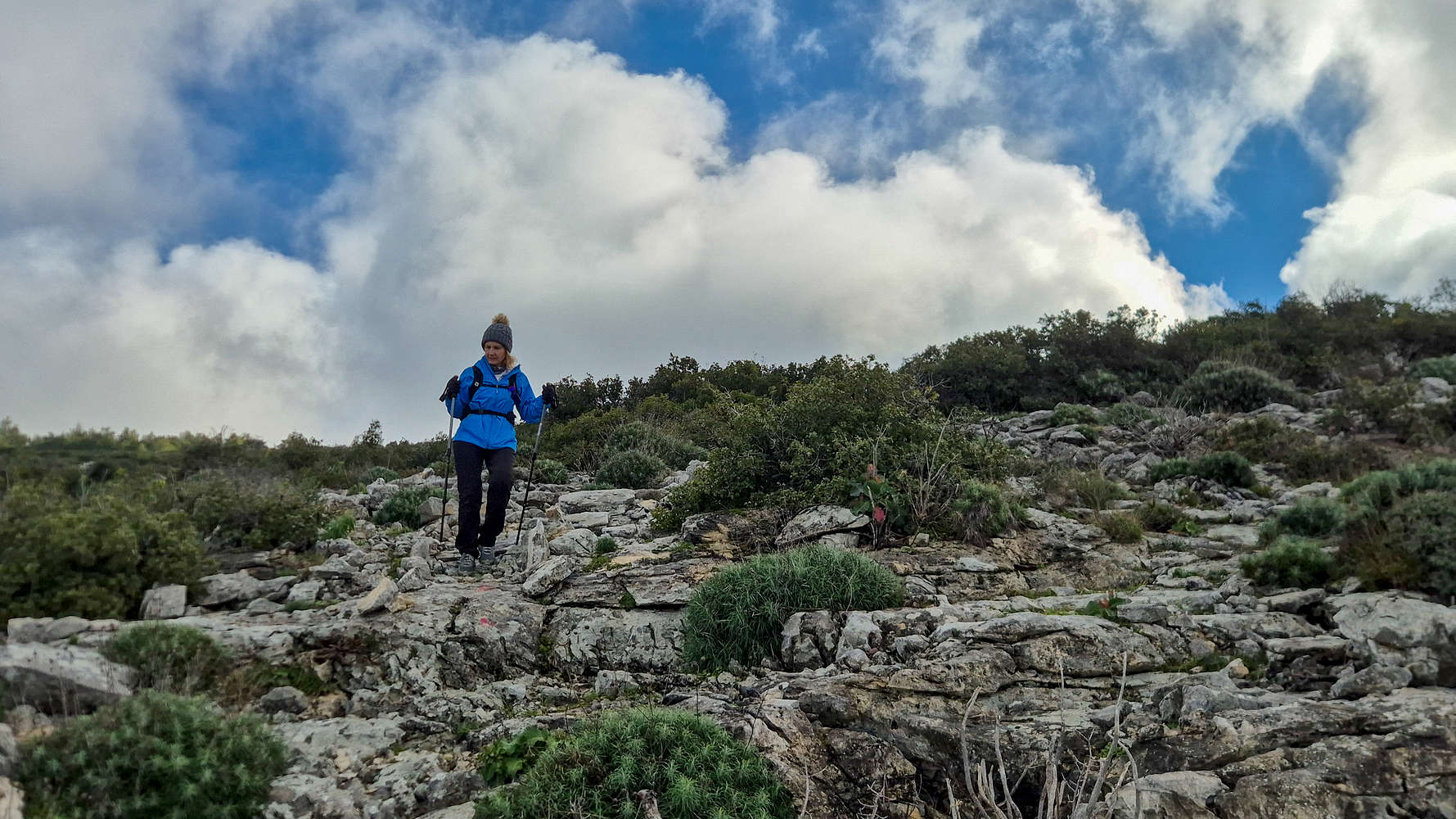
On the start of the South Ridge of Ymittos.
Lower portion of the ridge up to Point 966.
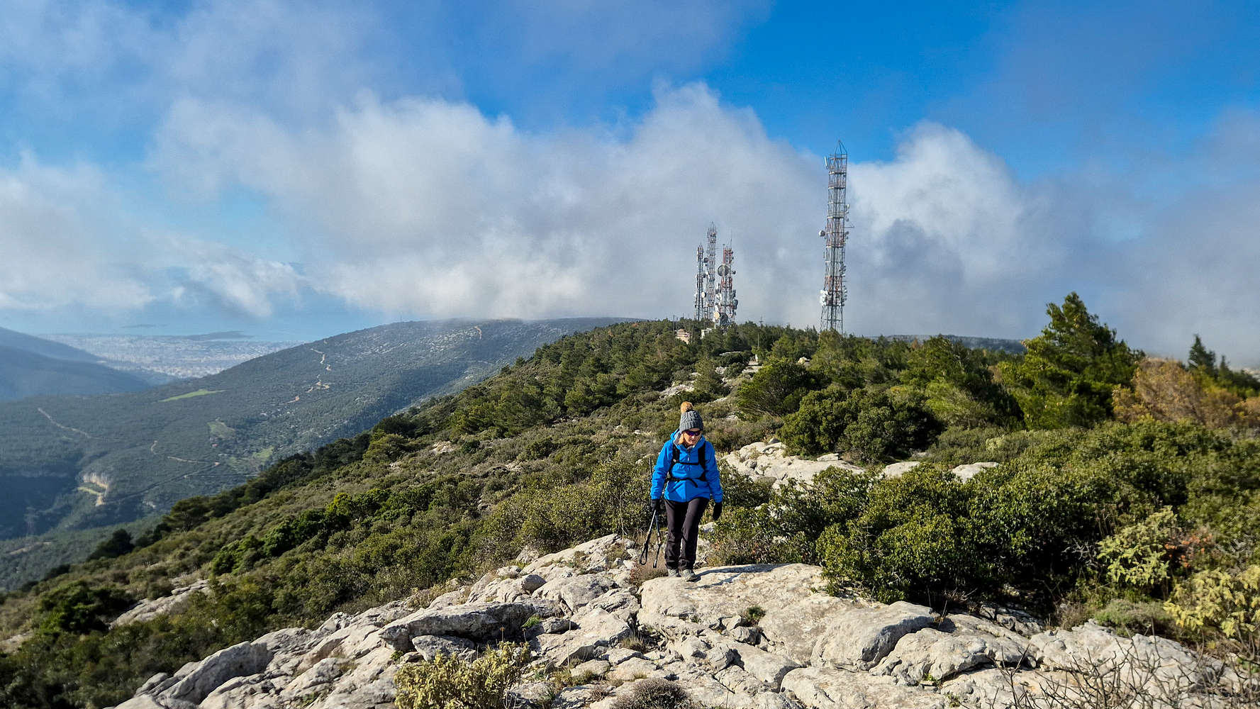
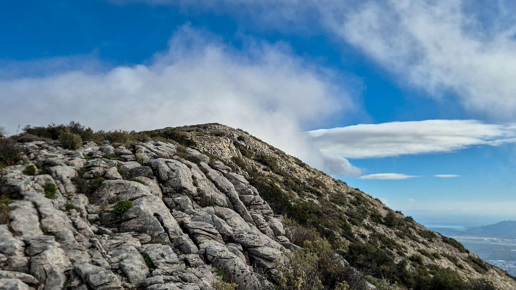
It is here, in the depression between Pirgos (814m) and Evzonas (1,026m), where the Mediterranean shrubbery is replaced by a more temperate arrangement of pines and fir. The lightness of the fog, smoothing over our vision gave an eerie feeling to the place. Only after we ascended a fair bit by the telecommunications towers, in the process setting off an alarm, that the clouds parted, and gave us a spectacular view towards the plains of east Attica, Sesi, and Tirpsithea Valley. Starting from the old German WW2 radar installation — just foundation — the ridge begins as a mellow T2 trail and gradually increases in steepness and exposure. It took us just under 2:00 hours to reach this point. The lower part of the route leads to Point 966 (966m) and is at points steep, with a nice airy feel, but little technical difficulty or necessary exposure (T2). We followed the unmarked and obvious crest, reaching Point 966 (966m) after 15 minutes from the radar.
Big exposure on the crest of Point 966.
Efzonas (1,026m) as seen from the ridge.
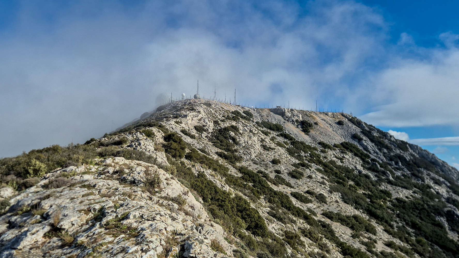
Reaching the base of some building, marked by a cairn, at this lower summit, we continued along the rocky crest of Point 966 in variable visibility and with strong winds. Here the exposure changes dramatically as the massive SE aspect opens up below. The theme continues on the 200m or so of the slightly descending rib which makes up the upper ridge. Exposure, and terrain difficulty depends on route selection, with ridge-edge at T3-, and a few steps inside at T2+ — attainable for most with some care. There are no technical moves, and exit is simple by descending left (W). We reached the notch without a problem and continued onto the steepening section leading onto the summit. Again, the going was non-technical, exposed, and possibly slippery walking (T2+). The final few meters to the fencing featured lots of loose scree and a ‘fluid’ trail, so care is necessary.
Views of the ridge & sea from the summit.
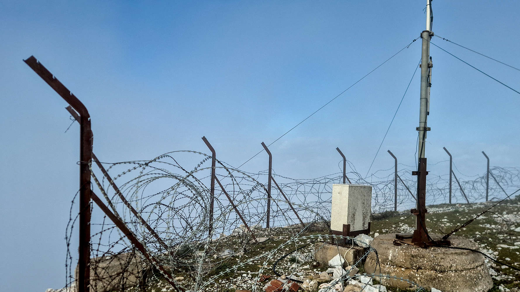
Fenced measurement station on the summit.
We reached the summit of Ymittos (1,026m) [P-792], our first P-600 of 2026, after 2:23 hours. In reality I may have waited for this moment at least the decade, since we started hiking, if not my whole 24 years. I suppose the first summit of an iconic peak like this, one which I see almost daily, should be notable, and this route certainly was. Reaching the insecure scree at the top, precariously positioned against the fencing, and thus stepping on the highest publicly accessible point, none of the magic was lost on me. Maybe it was lost soon thereafter while eating a slice of yummy Nieve-made apple-bread as the clouds engulfed us and the winds dropped temperatures to near zero.
Panoramic views South from Point 966.
This was quite enough for us, and we were happy to quickly turn our sights back down, looking to be home to enjoy the rest of the day. We descended the ridge, again without little difficulty, and enjoyed the growing grand views to the east and south. Especially from Point 966, a grand panorama of South Ymittos opens up beautifully. Sadly, clouds blocked views across into the Athens Basin. At Point 966 we turned right and followed a steep, difficult, and narrow track through the vegetation, for a direct descend to the FSR below. In just under 30 minutes from the summit, we were back onto the FSR and working our way across Pirgos (814m).
Descending through slabs on Ymittos.
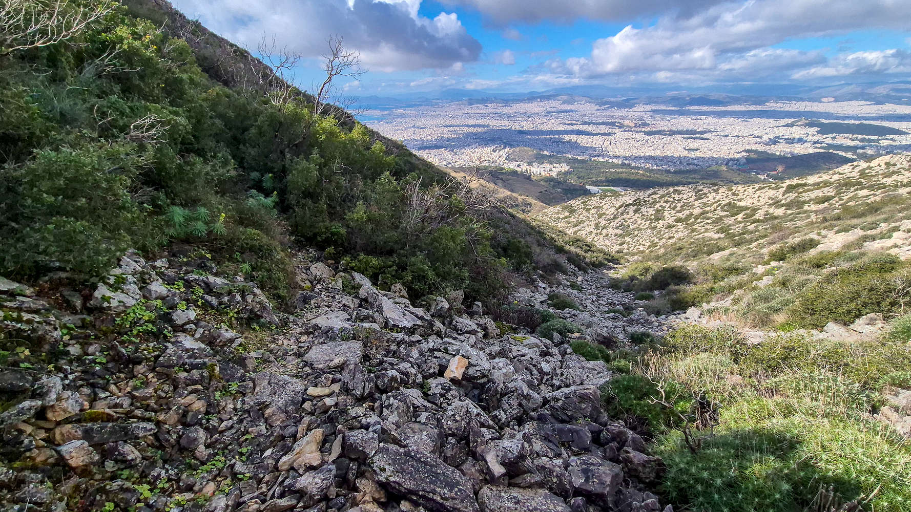
Traversing the ravine with views of Athens.
We intended to complete a sort of detour-loop which diverted away from the FSR sooner than our ascent route; passing by the place Gidospilia (Goat Cave). It took us just 10 minutes to reach our turn-off, and we began descending, again through a narrow, vegetated trail on the slabby terrain of the mountain. Even worse, many of the slabs were rather wet causing us to slip — lightly — more than once (T2+). While seeming like ages, we passed by Gidospilia after only 10 minutes, and descending via further vegetated slopes, we began entering into the rocky heart of this aspect. We followed the track on the steep and rocky side of one of the ‘ridges’ protruding from the face and after another 10 minutes we reached a large ravine which we traversed in full view of Athens.
Walking down on the Ancient Road.
Descending among ancient spoil-heaps.
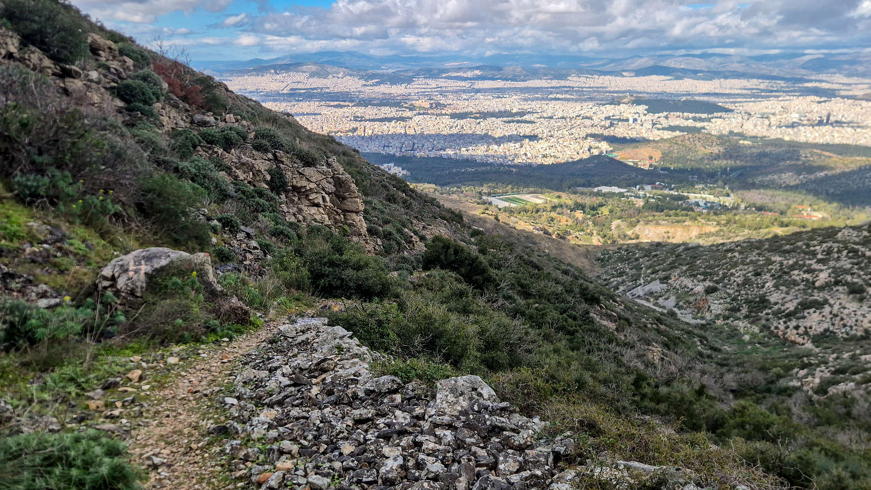
Some more traversing along the foot of an impressive band of rocks leading onto a beautiful terminal slab lasting around 5 minutes, brought us to the beginning — and highest point — of the Ancient Road. One of many ancient tracks on the Attica mountains, it leads us all the way back to Kareas on its wide smooth track, which today is overwhelmed by boulders (T2-). One can only imagine its glorious condition long ago. What it does offer until today, is a stunning view of the Athens Basin below, complete with The Acropolis. We followed it down along the ravine for 20 minutes, passing by the ancient quarries, and reached the area above the Monastery. We avoided our scree-like ascent variation and descended via some spoil-heaps instead. As the noon heat began to make its presence known, and climbers crowded the Ilioupoli Crag, we returned again to The Throne. I took a minute to climb a cool slab right behind it (V1) before making our way back down to the car. In total it took us just under 4:15 hours with more than 30 minutes of breaks, but yet the time was still 13:00 so we’d have plenty of time to enjoy the rest of the day at home.
Interactive Map
Logistics
No logistics, just drove from the house in Athens in about 25 minutes. We parked right in front of the Monastery of St. John at Kareas (📍Google Maps), and just drove back once we returned.
Nearby Peaks
The following is a list of significant nearby peaks.