Agriliki (558m) [P-238]
Summited On: March 7, 2026
Region: Nea Makri, Attica, Central Greece, Greece.
Overview
Agriliki (558m) [P-238] (”Αγριλίκι”) is a prominent yet compact massif situated on the NE side of Oros Penteli (1,109m), which rises steeply from sea-level near the coastal town of Nea Makri (”Νέα Μάκρη”), it is separated from wider Penteli via Agios Petros Col. and historically associated with the Battle of Marathon (490 BC). While its status as a low sub-peak means it is little trafficked by hikers, its sharp limestone summit, and steep direct Eastern route was enough to pique our interest.
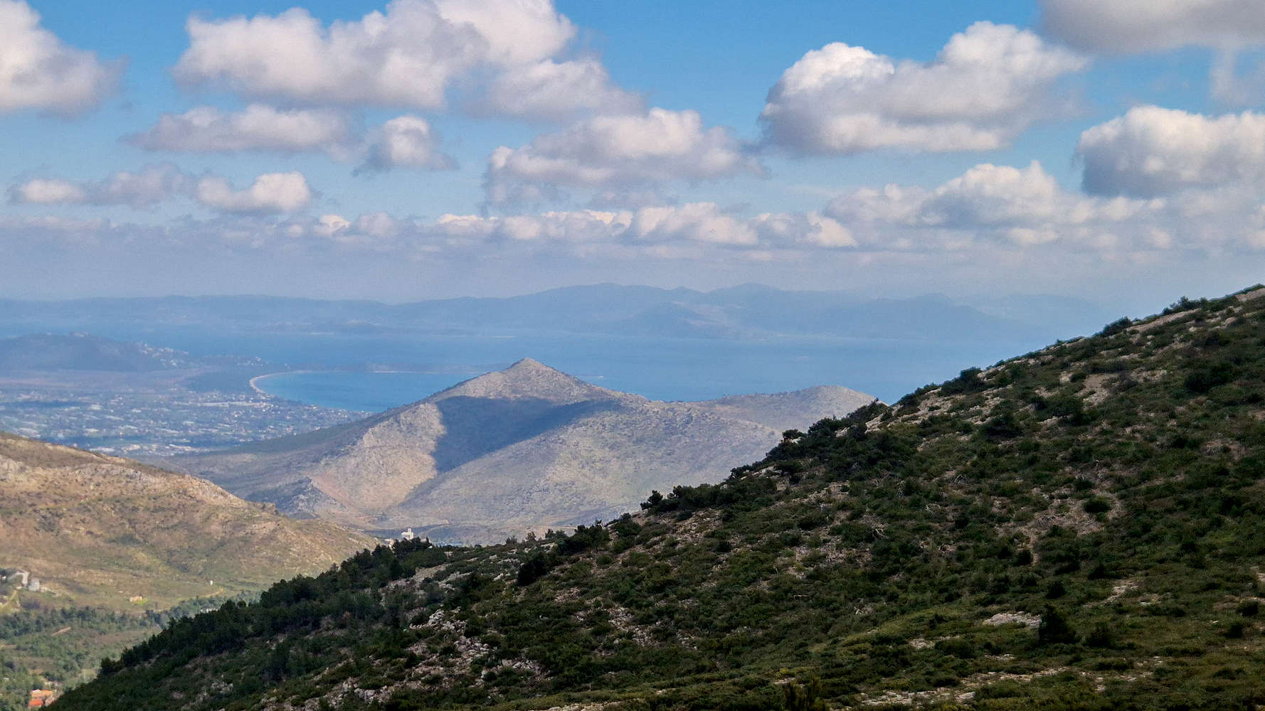
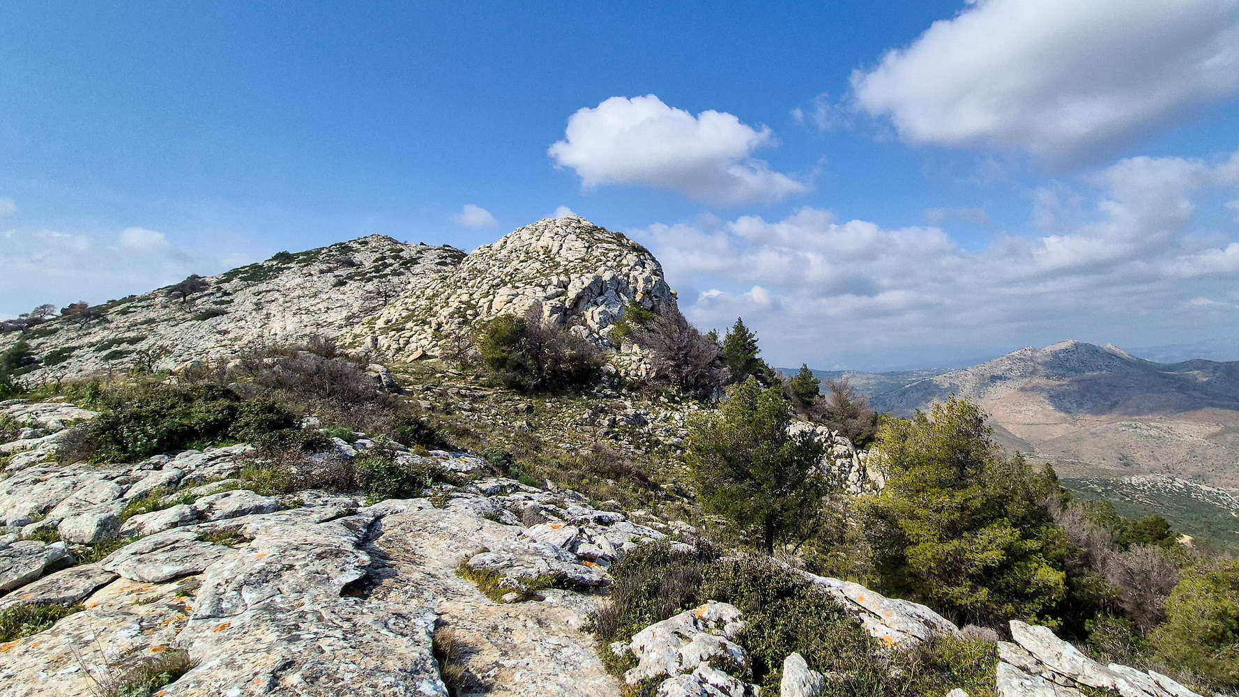
Agriliki (558m) as seen from Penteli (1,109m).
On a low ridge of Agriliki (558m), directly above Marathon, sits the Acropolis of Marathon a 4th century BC ellipsoid Mycenean fortification. According to some accounts, it was the site which general Miltiades (b. 550 BC) utilized in order to observe the movements of Persian troops during the Battle of Marathon (490 BC). Today, it houses a crudely constructed chapel of St. George. The wider area of Nea Makri also hosts a diverse selection of archeological sites, while on the Western side, South of the village of Vranas (”Βρανάς”) the Rapetsona Reservoir and Roman Aqueduct ruins can be found.
The name Agriliki derives from the plentiful wild-olives (Αγριελιές) on the low Eastern slopes which were planted by the first residents of the area.
Route
Having caught a glimpse of the summit of Agriliki (558m) during our ascent of Penteli (1,109m) the week prior, and having heard about the ESE route from Nea Makri, it was easy to short-list it. With Terry looking ahead at a busy weekend we also had to keep our outings short, we didn’t hesitate to select it as our objective. After all it offered the greatest elevation gain of all our sub-4 hour door-to-door options. With a solid plan in mind, plenty of time, and good weather we met up in central Athens at 08:30 and drove the 40 minutes to the trailhead by the Nea Makri Health Center.
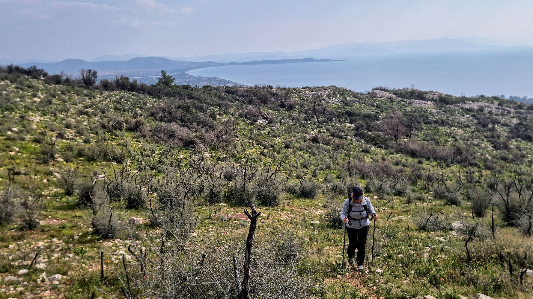
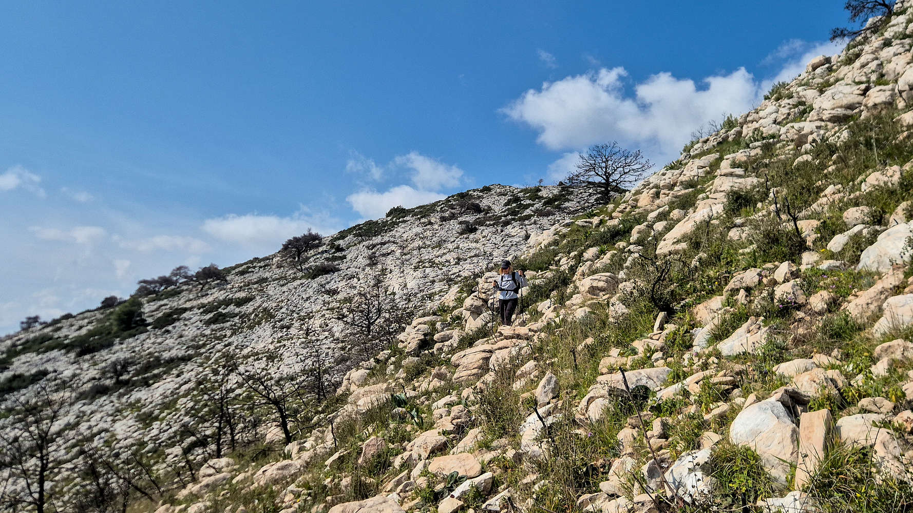
From the trailhead we could make out the steep valley which curves left towards the summit, featuring blocks of bright limestone, that would serve as our route. As usual on these lower ascents where a quasi-goal is to avoid roads, the lower — forested — sections of the mountain are usually the real challenge and may require bushwhacking. We expected this, but luckily faint red paint and an intermittent track through the olive groves at this elevation quickly provided us passage (T2-). As the terrain steepened, we continued in an increasingly sparse forest, following the contours of the valley. After about 25 minutes we broke unto the flatter ground by the ruins of the Acropolis of Marathon, but staying on course avoided passing through it, and made our way into the burnt forest with views of Schinias Marathon National Park (T2-).
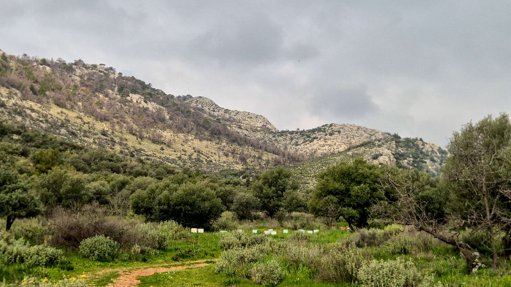
An overcast Agriliki (558m) from the trailhead.
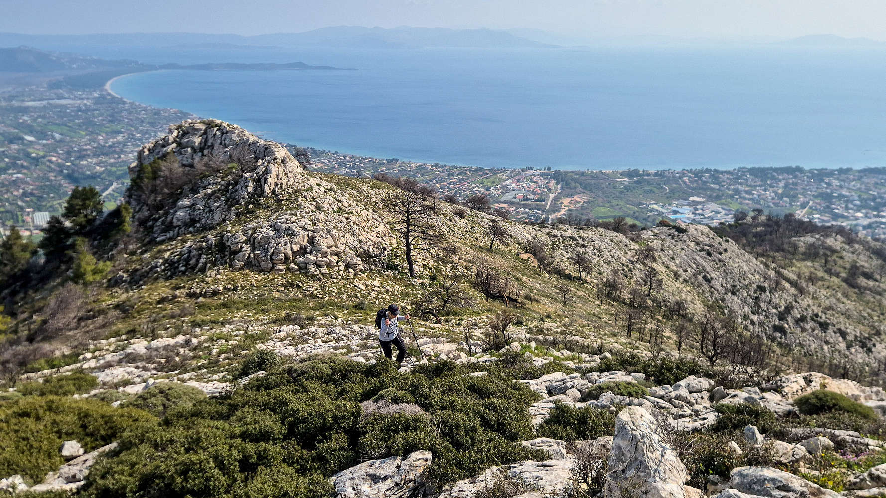
Hiking past the ruins with views of Sxoinias Bay.
At this point, the olives and shrubs of lower elevations give way to a once dense collection of pine, strewn across the valley-bed, but also steeply clinging to the slopes of the headwall above and around us. Charred black from recent fires, in a macabre contrast to the lush undergrowth of early-March, the trees offered us little protection, often hindered our progress and managed to turn my trousers black as well. After about 15 minutes on an increasingly steep and rocky track, the base of the lower ‘headwall’ is reached (T2). From here navigation is done via cairns and very few red marks.
Expansive views of the coast from the base of the lower headwall.
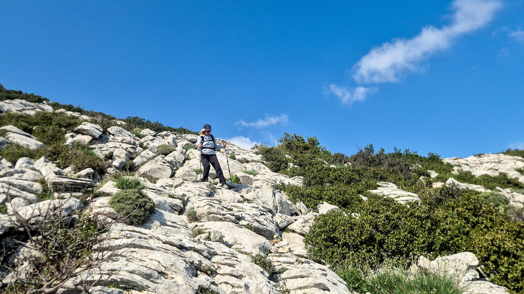
The lower headwall enables access onto the lower East ridge, and slowly increases in incline. Throughout, very easy face scrambling is required, often possible without the use of hands (T3-). The main concern are the vegetated sections between boulders. Towards the top a few bands are steeper, while the exit is provided by a ledge near the crest (T2+), which we then follow to the left. In total it took us about 50 minutes to reach the ridge.
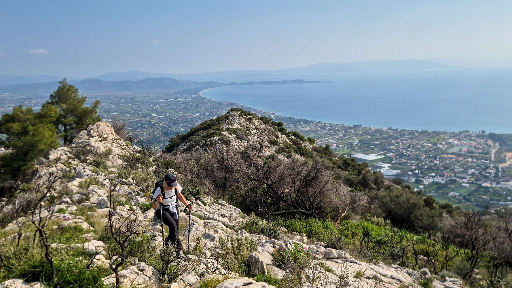
On the East Ridge with Schinias Bay far below.
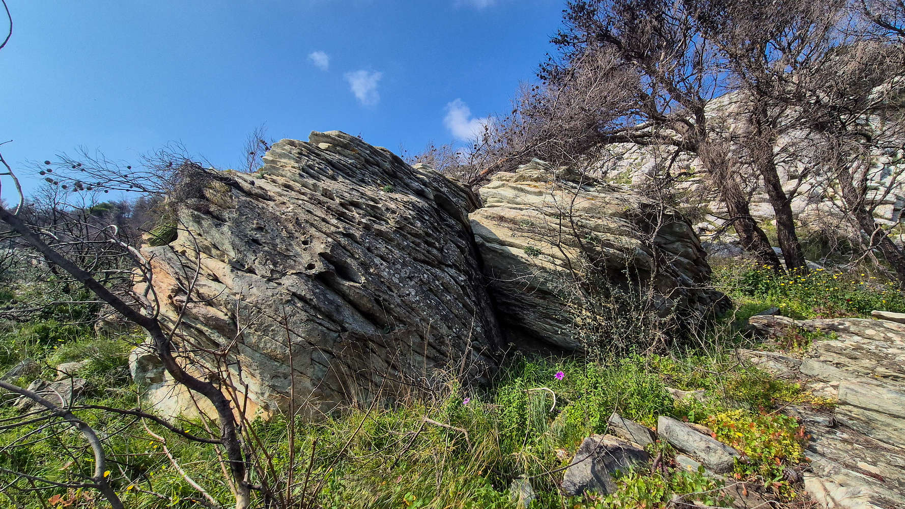
The beautiful ‘double’ Blueschist boulder at 375m.
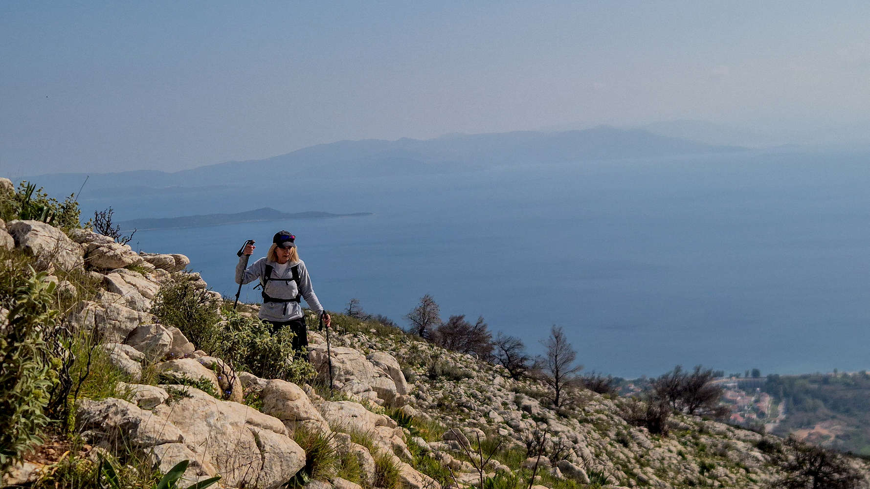
We traversed along the ridge with incredible views of Schinias Bay and were happy to find some respite. The beautiful rocks of the NE headwall shone under the sunlight as we reached the notch on the ridge which leads to the upper sections. Here a beautiful lone boulder of Blueschist, a common sight in the Cyclades, stood proudly. We took a couple of minutes of rest before traversing along the base of the upper headwall, within 1 hour we reached had reached the slabs which would lead us to the summit.
Scrambling at the start of the upper headwall.
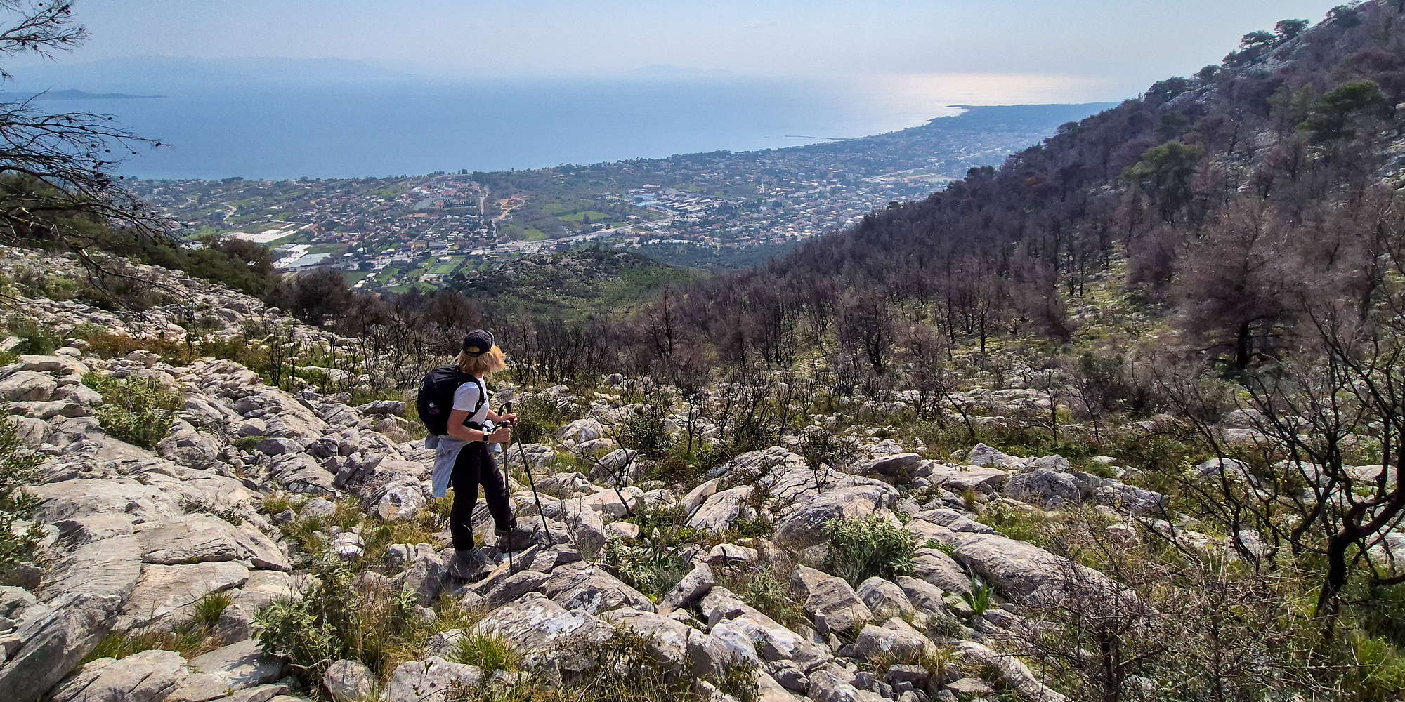
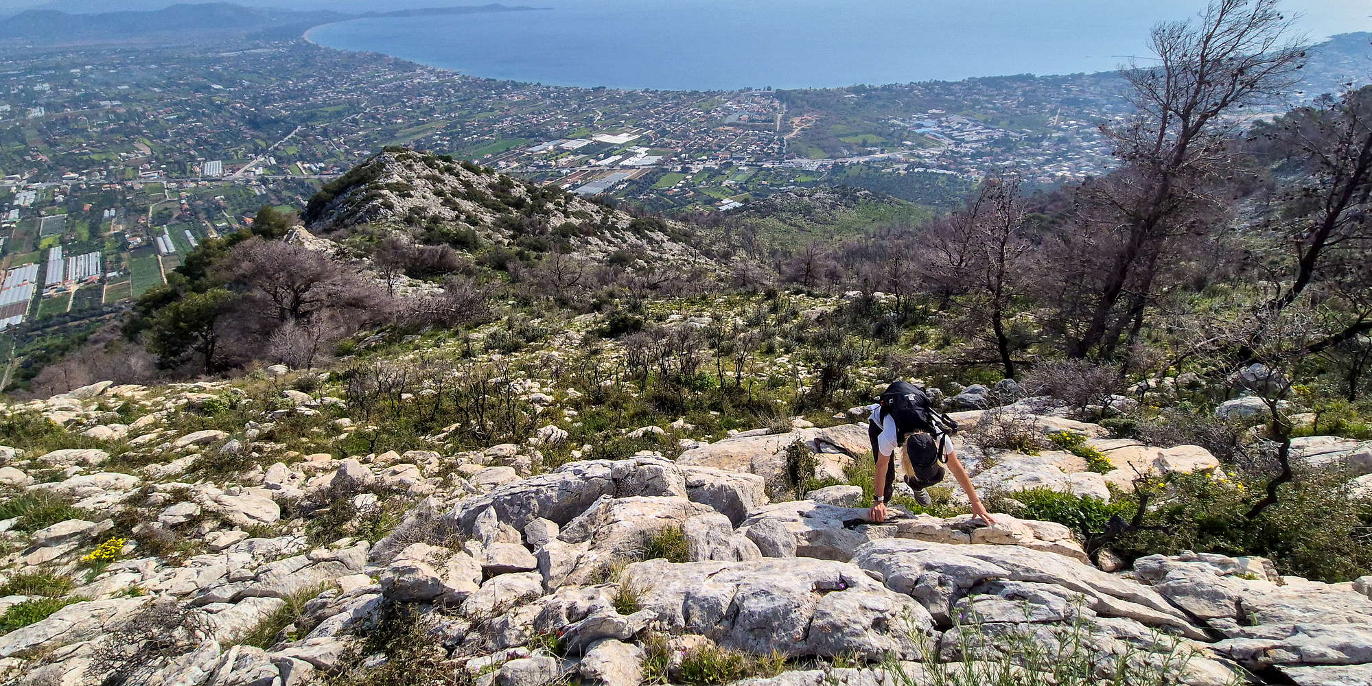
The upper headwall is the crux of the route, with some of the steepest face scrambling (T3, Class I) and is also much more sustained, on account of bigger slabs. Again the scrambling is very easy and enjoyable, although not technically engaging. For experienced hikers and climbers with good balance much can be done without the use of hands. The exit is provided at the crest of the ridge opposite the NE headwall at around 446m of altitude.
Negotiating the very easy slabs atop the East Ridge and NE headwall.
The rocky foresummit (right), and true summit (left).
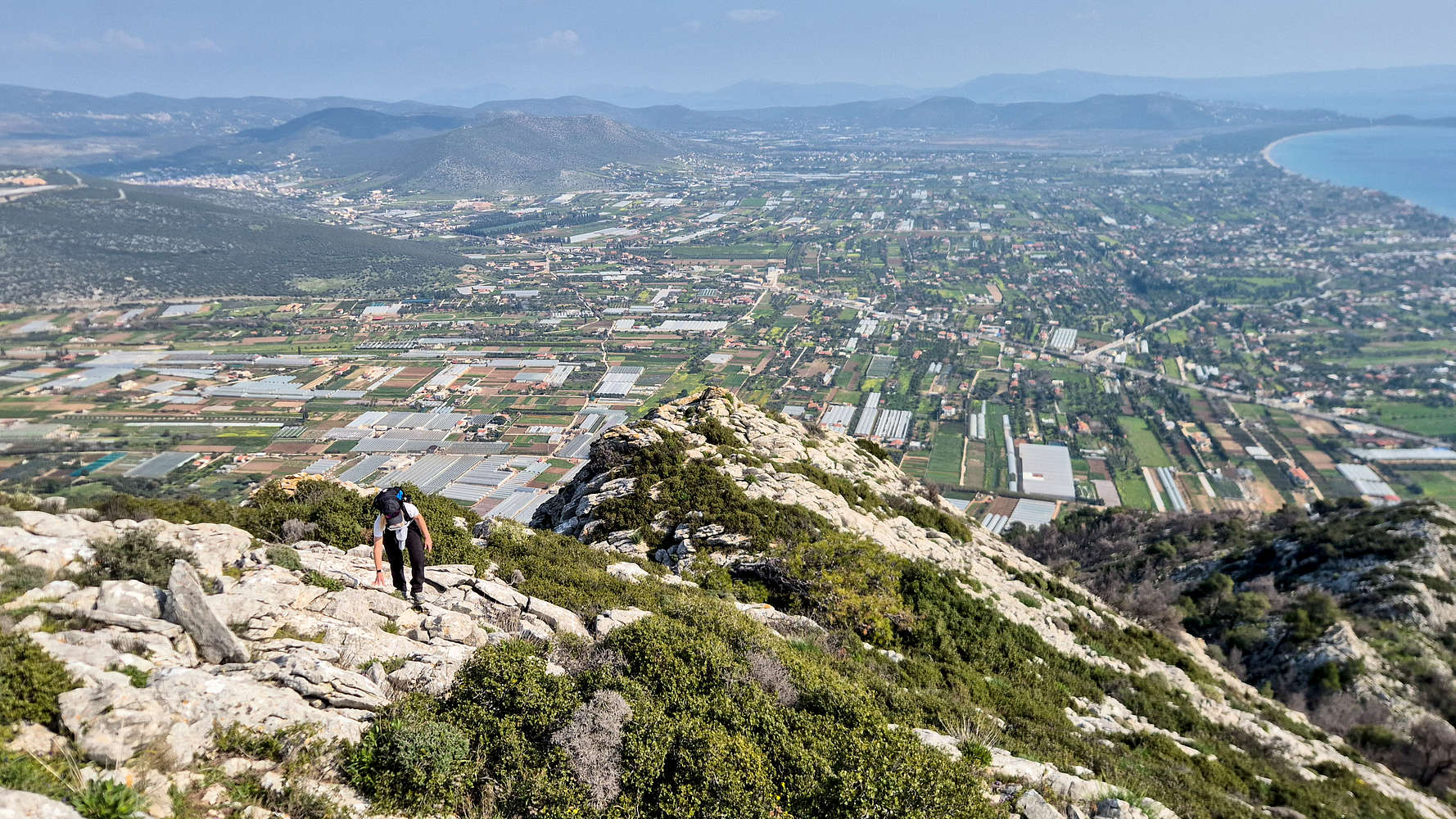
Having reached the top of this section after 1:11 hours, we were curious about the length of the remainder of the route, since we were over 100m below the summit in elevation. Finally properly exposed to the North, we faced our first winds of the day as we navigated the final airy slabs (T3-) on the East Ridge, leading towards a flat point that provides access to the rocky foresummit of Strouggiza — which we avoided.
Traversing under Strouggiza, far above the sea.
On the final few meters to the true summit.
We traversed around the base of the Strouggiza via a system of ledges (T3-), which offered rather spectacular view of the central, and steeper, valley of the South face. However, the true extent of the fire damage on the massif was now clear. One can only imagine how much more scenic this route would have been had these forests still been lush and unharmed. At least that is still the case on the North aspect. Reaching the Col. below the true summit, we took a direct line up the rocky slope, following the right (NE) ridge in a light left-wards crest (T2+). We topped out on the steep and airy summit of Agriliki (558m) after 1 hour and 32 minutes, and enjoyed exceptional views of the sea, Penteli (1,109m), Schinias Marathon National Park, and the assortment of peaks stretching far to the North.
Retracing the traverse below Strouggiza.
The upper crux slabs and Terry for scale.
After 15 minutes at the summit, lucky to have found a wind-protected sitting spot, and once again enjoying Nieve’s home-made apple-cake, we set our sights downwards. As usual, we would have to retrace our steps, and descending much of the technical ground could prove time consuming. The rough terrain of the summit cone was a poor start to the descent, but the traverse, and top of the East Ridge were completed rather quickly. As was expected, the downclimbing (or downhiking) of the crux section proved easy, yet not thoughtless for myself, and quite a bit slower for Terry and her injured knee. Yet we made it back to the Blueschist boulder in quick time, and would soon be past any technical sections.
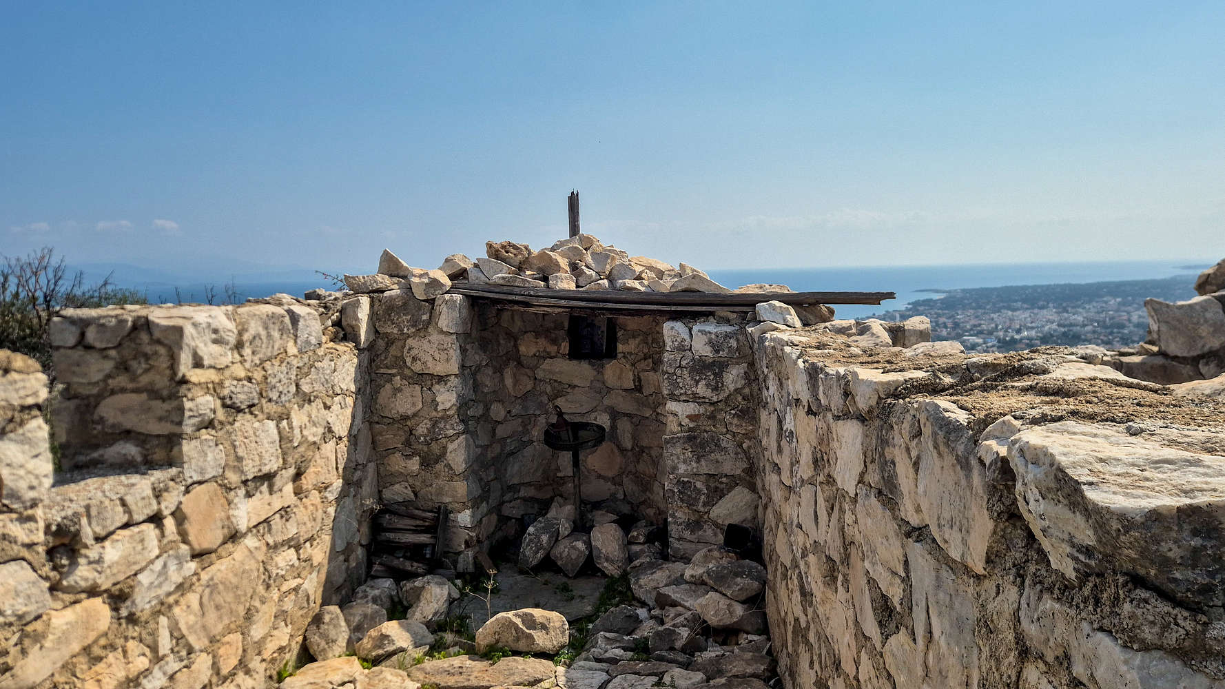
The Chapel of St. George at Acropolis of Marathon.
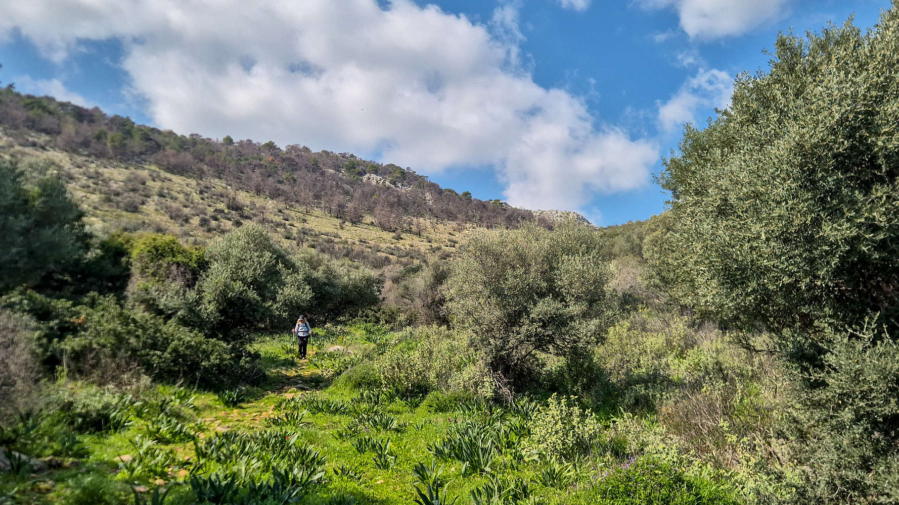
Exiting the low forest of olives on Agriliki (558m).
Luckily, the lower headwall proved much easier to navigate on the descent, and we were back on the rocky forest trail and losing elevation quickly. We faithfully followed the faint track on the return, making up for our slower pace above. It took us just a few minutes to exit onto the tree-less plateau by the Acropolis ruins. The visible small wall lured me in, and we opted to walk the extra 5 minutes to see it. Among the scattered limestone blocks that once made up the ancient fortification, stood a crudely built chapel of Saint George. A rather symbolic find for us. We soon rejoined the trail and began our descent through the lower forest. Again following the trail as well as possible helped us increase our pace, and we were soon on flat ground. Although we did get a little lost at the bottom, it was not hard to find a suitable exit, and just a few meters from the parking area, we even ran into the local beekeeper, in the middle of his work. It was good to be back down after just over 1 hour.
Our outing lasted just over 4 hours door-to-door, a pleasant surprise made even doubly so since I was made aware of plans for sport climbing in the afternoon, giving me just enough time to eat lunch, relax, and head back out to climb.
Interactive Map
Logistics
As a peak in the periphery of Athens, it required very little logistical planning. We simply drove the 40 minutes or so from the center of Athens to the trailhead (📍Google Maps) near the Nea Makri Health Center. While there is worthwhile sightseeing in the area, we opted to drive back home.
Nearby Peaks
The following is a list of significant nearby peaks.