Kithaironas (1,409m) [P-827]
Summited On: June 14, 2025
Region: Attica, Central Greece, Greece.
Overview
Kithaironas (1,409m) [”Κιθαιρώνας”] is the second highest mountain in the Attica administrative department and features a prominence in excess of 600m (P-827). While generally overlooked, mostly due to it being paved and accessible up to the summit, the classic E → W ridge route offers an enjoyable short outing from Athens with excellent views and interesting terrain. The traditional ‘low-impact’ trailhead for this route is via the Hellenic Mountaineering Club (HMC) of Eleusina Refuge “Vaggelis Tsakos”, located at 1,090m on the Eastern ridge of the main massif. From there just under 400m of elevation gain are required to reach the summit, some 5km away.
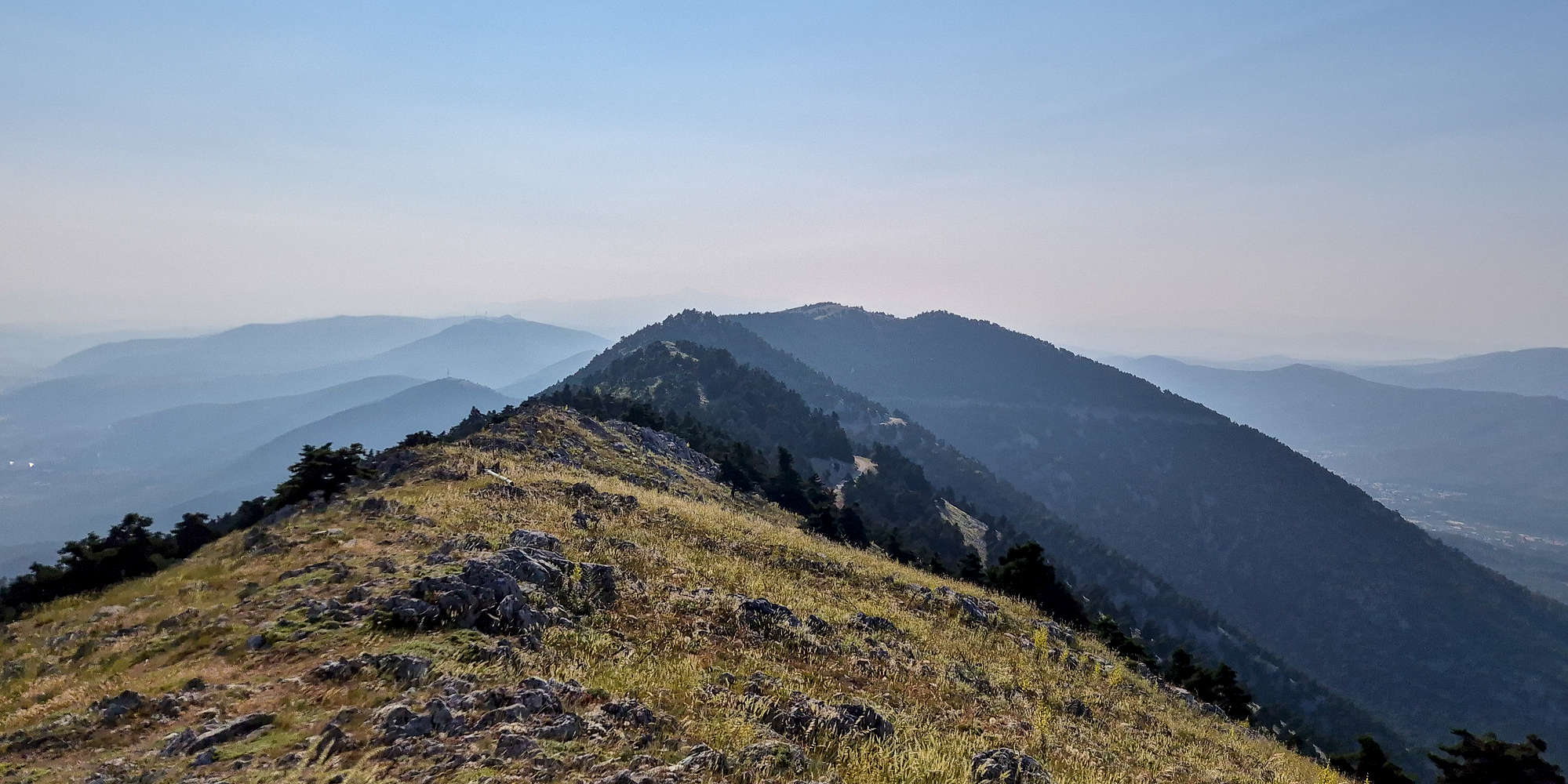
Busy view to the W of the summit. Korombili P-600 visible left of center.
Although Terry had already summited Kithaironas (1,409m) a few years ago, car troubles (damn electronics) required we pick a close-by and paved-road trailhead for our usual weekend objective. With these conditions in mind, Kithaironas (1,409m) is the near obvious choice, as other Attica objectives would certainly be too hot by 9AM. As such we set our alarms for 5AM the next day and enjoyed sleeping in our beds for once this season.
It seems that rumors of large populations of boars on Kithaironas, at least its higher reaches, are generally unfounded. Arrived at 6:45am and stayed until 10:30am and didn’t see any.
A Susinct Ridge
Starting from Central Athens at 5:45AM, delayed as per usual, we left the city under the soft dawn sunlight and through empty roads quickly made our way to Mandra from which the city roads would turn provincial and other drivers were now few and far between. We meandered through the hills connecting Mandra, and the local Pateras (1,132m) massif to Kithaironas (1,409m), and by 7:20AM we were set and ready at the “Vaggelis Tsakos” trailhead.
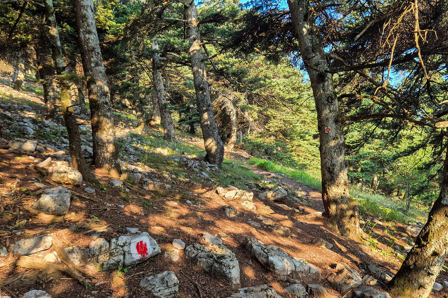
Well marked forested section at the beginning.
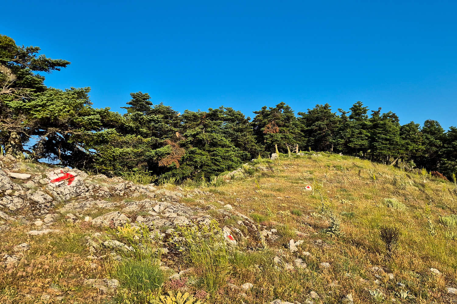
The ridge top-out with an arrow pointing towards Elatias 1,409m
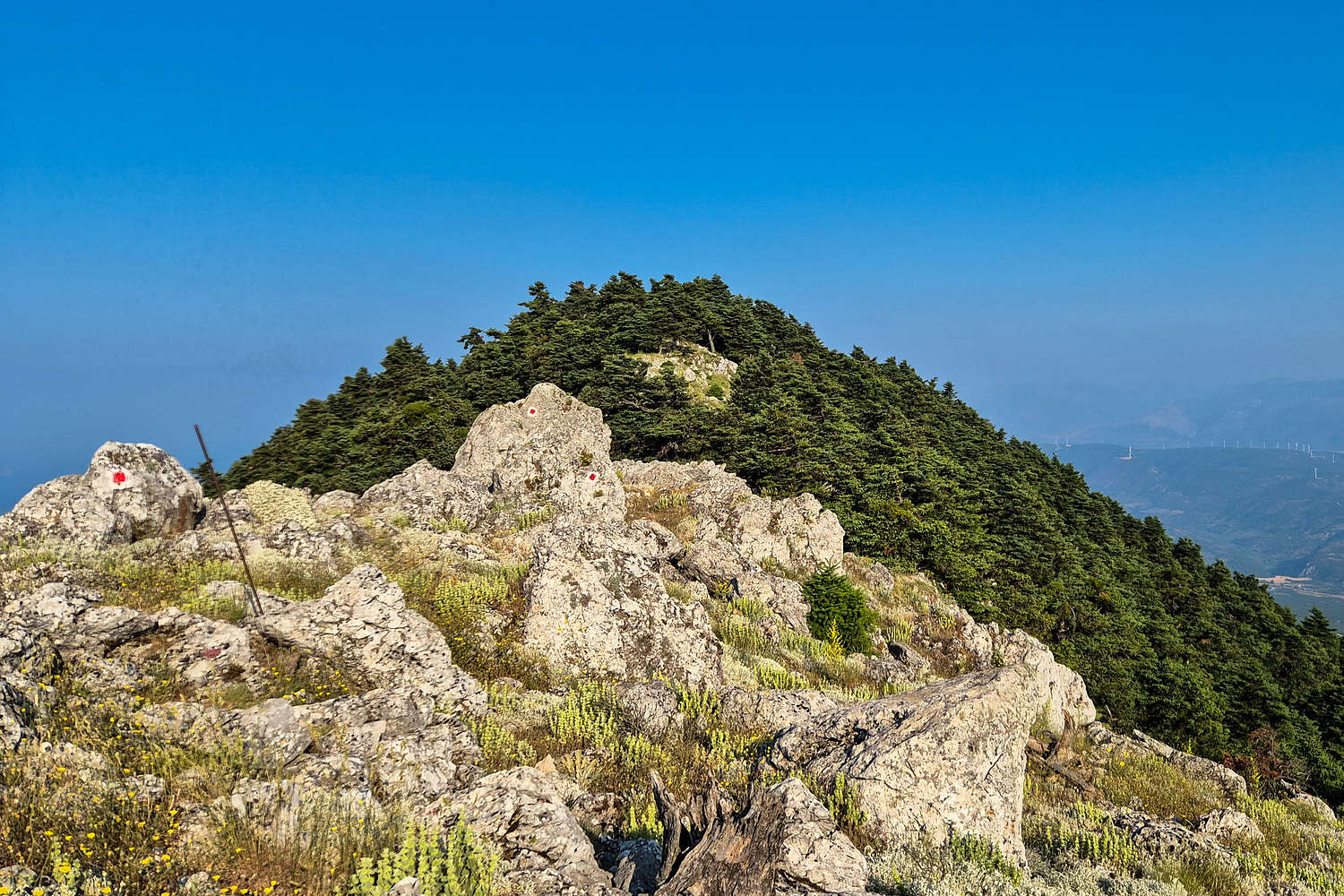
The route begins through a sparse pine forest which provides much needed shade since this section gets hit by the sun early in the day. The track here is very visible and very well marked. The forest ascent section contains about 50% of the overall vertical gain, rising ~240m in the first 30 minutes. Once at the Tries Korufes Intersection & Col. (1,330m) the trail continues on the obvious ridge, however, it is possible to turn left and make a quick ascent of Tries Korufes (1,354m), the massifs Eastmost summit. We opted not to do this on our ascent assuming we would be returning via the same route - we did not.
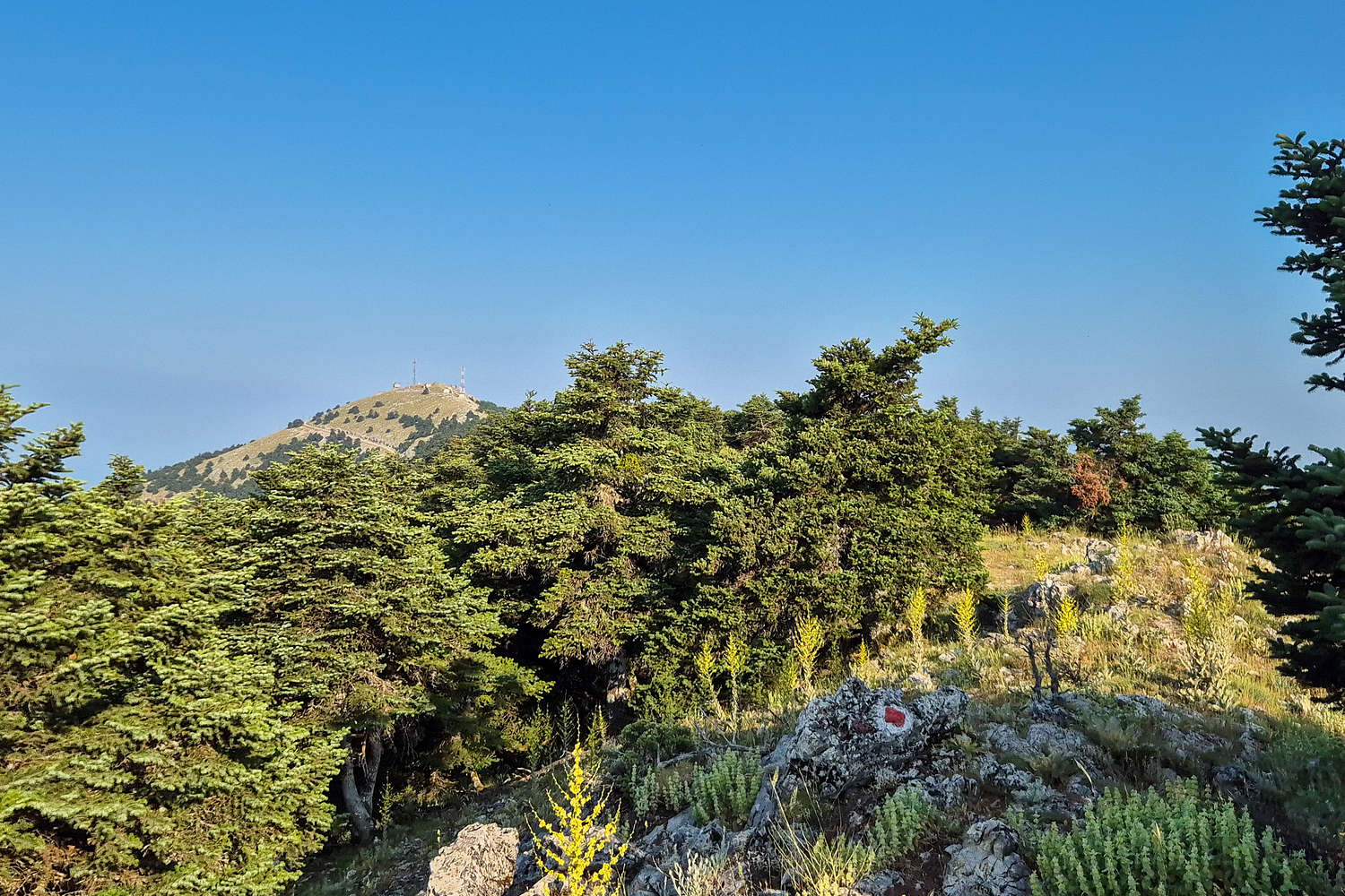
Elatias as seen from the 2nd crest on the ridge.
The forested 3rd crest from the 2nd crest top-out, summit not visible.
Continuing due West the trail continues on the ridge with the terrain remaining pleasant, same with the view, which now offers uninterrupted views across the Halcyon Gulf and towards Geraneia (1,369m) [P-1000]. On this particular Saturday we also caught a great view of Mark Zuckerberg’s yacht and “toy-tender” which continued to look gigantic even from 1,400m above. Following Tries Korufes Col. the trail descends slowly before the ridges 3rd crest, a heavily wooded sub-peak which blocks views to the onwards route, and the crux. This 3rd crest offers the most forested section of the route which was rather welcome as the morning sun had finally caught up to us. Topping out at this crest we also got a great view of the route’s crux, a rather unwelcome sight as the clock ticked past 1 hour.
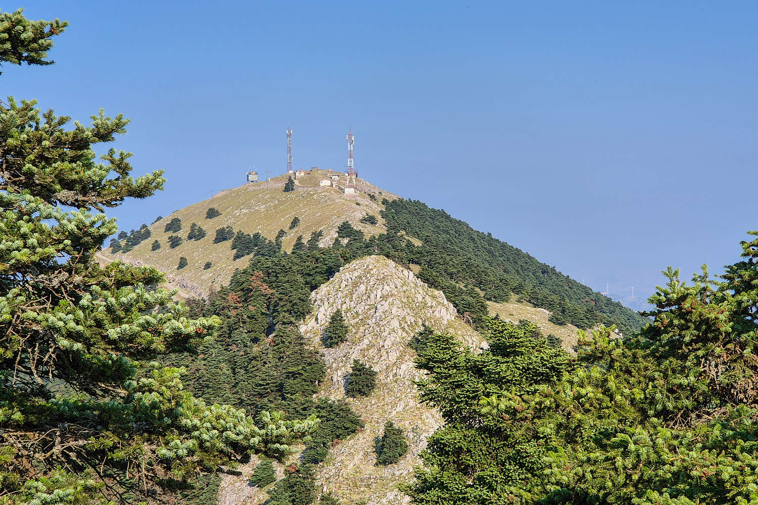
Elatias summit with the 4th and crux crest visible in the foreground.
Topping out on the Elatias crux crest, Tries Korufes (1,358m) visible far behind.
The crux of the route is the 4th and penultimate crest of the ridge which is by far the steepest and features what can only be described as faux scrambling. The trail, well marked, continues on the rocky ridge of this crest and can be hiked without the use of hands; that is not to say that it is easy or relaxed. Luckily it is generally not exposed. This airy crest was the final mini-challenge for this summit and topping out put us withing breathing distance of the first (Eastmost) summit installations. In a few minutes we made our way to the chapel of Prophet Elijah, a common sight on Greek highpoints, and slowly looped the road to the true summit right above. The exposed flat summit was uninspiring and so was the roadside siting area we enjoyed our break at, and therefore quickly continued on a walk to investigate the numerous buildings on the summit. Upon inspection we concluded that it was the site of a former military base.
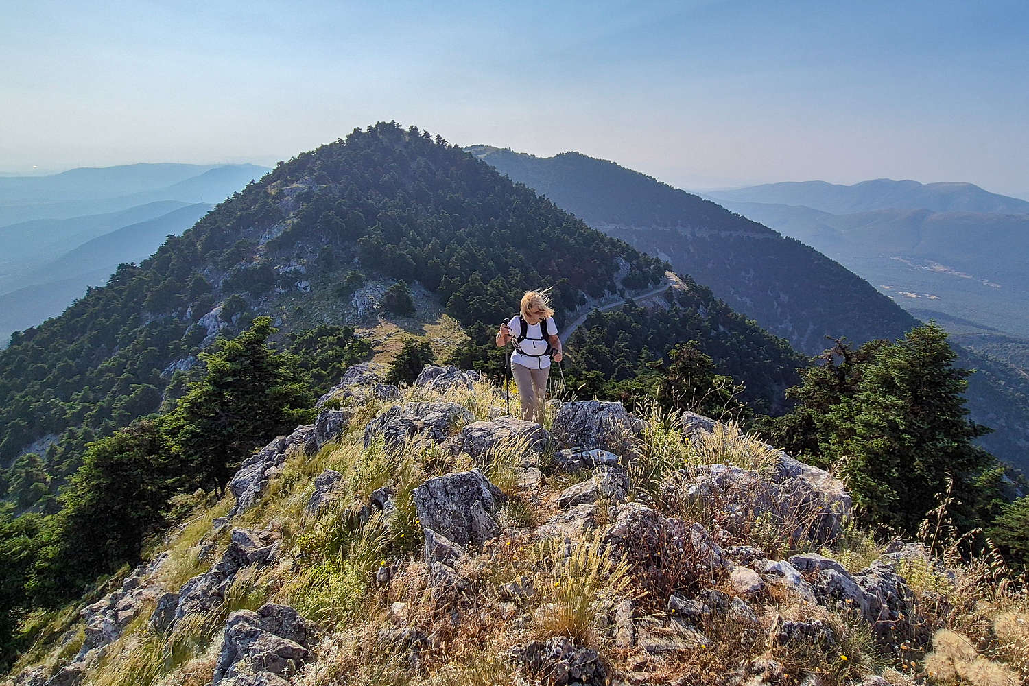
The long ridge of Kithaironas from the summit.
For the descent we took advantage of the road to ensure less strain on the knees as both of us are having trouble recently and are expected to embark on an expedition to Italy within the month. From Terry’s previous summit it was known that this is the preferred descent route, since she had returned via the trail only to find another party who left at the same time already resting at the trailhead.
Visiting Eleutherai Fortress
We took advantage of the really nice weather to enjoy an hour or so more of this quiet early morning and thus drove into the village of Vilia, known as Attica’s snowiest, for an extremely overpriced lemonade and can of coke before heading to a lesser known archeological site. There are countless of these around Greece but the Fortress of Eleutherai is especially interesting.
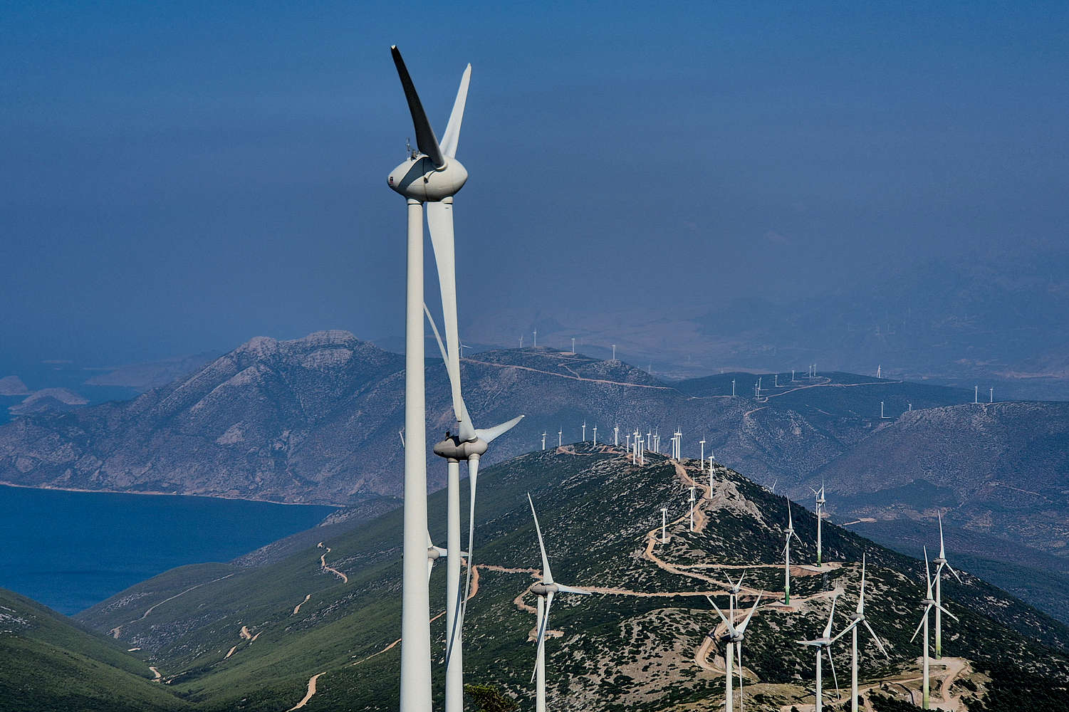
The Fortress of Eleutherai is a defensive outpost built on the southern side of the Kaza Pass (”Πέρασμα Κάζας”) around the 4th century BC, most probably by Thebes, since the Athenian fortified village of Oinoi (”Οινόη“) is nearby. Its outer walls and towers are constructed with cyclopean-type massive limestone blocks probably from Pastra (1,025m) [P-380], Kithairon’s Eastern extension, today covered with wind turbines. The architecture and condition of the defensive system of the N-NE side is still very impressive, and it is one of the very few obvious wall-and-tower fortifications in Greece, especially of that age.
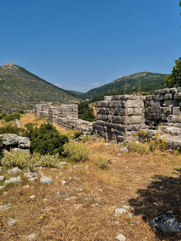
View of the N walls & towers of Eleutherai Fortress.
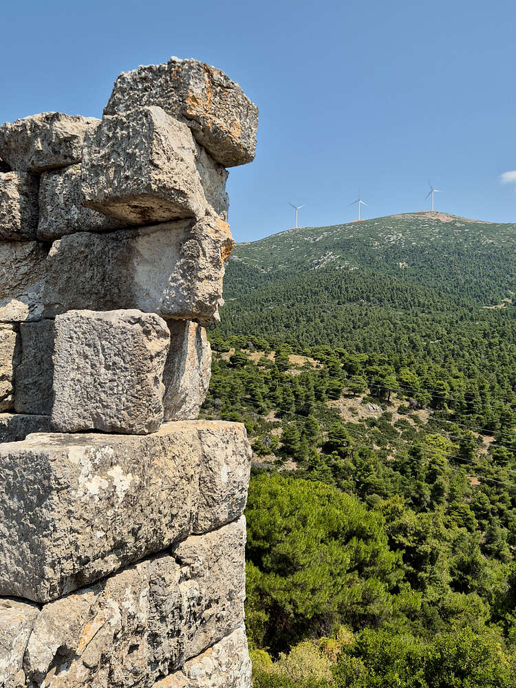
The wind-turbines, a modern “fortification”, overlooking the much older Eleutherai Fortress.
The site is somewhat well kept with a clear-ish trail and a bench! It of course had some trash thrown around but surprisingly the information plaque was in good condition. A true hidden gem for anyone visiting this quite random corner of Central Greece. Access can be a bit tricky with the turn off right before the “Kaza” tavern and bus stop(!)
Interactive Map
Logistics
No logistics. Easy to do self-guided from Athens as a morning excursion. Most rental cars will take you to the trailhead just fine.
Nearby Peaks
Notable summits exceeding 1,000m asl. nearby, incl. Korombili (907m) [P-600].
Pastra (1,025m) [P-300]
Pateras (1,132m) [P-500]
Korombili (907m) [P-600]