Oxia (1,926m) [P-396]
Summited On: May 6, 2024
Region: Fthiotida, Central Greece, Greece.
Overview
Oxia (1,926m) [P-396] [”Οξυά”] is a minor and low-slung massif between Vardoussia (2,495m) [P-1289] and Tymfirstos (2,315m) [P-1117] generally overlooked by Athenians due to its remote location. In fact the most popular approach is from the South with the village of “Grammeni Oxia” (Written-on Beech) being considered the N-most part of mountainous Nafpaktos. The mountains’ claim to fame is the large Beech forest after which it is named, which populates the majority of its slopes above 1,650m and as high as 1,870m on the N Face. This Beech forest is the Southern-most in Europe and a result of the soft sedimentary geology of the massif, undoubtably driven by the erosion of its massive neighbours. Nonetheless this had served to form a beautiful massif which should not in any way be underestimated.
![Jason on Oxia (1,926m) [P-396] E ridge, just above the forest.](https://images-sp.summitpost.org/tr:e-sharpen,e-contrast-1,fit-max,q-60,h-1000/1085473.jpg)
Jason on Oxia (1,926m) [P-396] E ridge, just above the forest.
In fact, the addition of “Grammeni” (Written-on) to the village and area toponym is intertwined with the biggest danger of this mountain, adverse weather. According to the legend a local bandit chief was once caught in a wild wind-storm on the summit ridge with his comrades. He was only saved by holding onto one of the Beech trees, and would go on to carve on it his name and the date; hence the curious addition to the name. Furthermore, the summit toponym (”Sarantaina”) is also related to a tragic weather driven event, one where a wedding part of forty people (Saranta) perished while traversing the massif during a freak spring storm. Even today, it is well known that adverse weather, extreme cold, and persistent snows are features of this lonely and hidden mountain.
Our visit during the dry May of 2024 would feature none of these elements, but heavily center on the complete stillness and abject remoteness of this mountain, forgotten within overgrown valleys and little mentioned among the few elders who still live on its slopes. Nature truly seems to have consumed the thin human presence which has existed on these slopes and elevated valleys. Shut down cafes, empty town centers, locked churches, and overgrown plants, intruding into roads and buildings alike is the hallmark of the N aspect of this massif. During our visit we visited an abandoned village fully consumed by nature in the last 70 years, and saw a cafe overgrown and teetering from c. 2000; finally I was privy to rumors and stories from the few locals about the frequent intrusion of wolves into the villages.
Route
Staying at the miniscule settlement of Pougakia on the NW slopes of the massif we drove a fair way on a combination of tarmac and gravel roads, gaining height through the mountain with the objective of the Grammeni Oxia Pass at 1,630m from which the summit trail begins. Besides narrow sections and the long distance the approach roads were not memorable, and drivable with a 2WD is dry conditions. Reaching the Pass we realized we would continue ascending an additional 30-40m of gain towards the refuge by driving the steep supply road. The turns were fine but a massive ditch cut across the road about 200m from the refuge; we parked to the side next to a Panda 4x4 (!!) and soon headed off.
We started off quite late, at almost 11:45am but that meant finding a few people at the refuge who were also enjoying the morning. Since the weather had remained stable there was little concern about staying up high until late, although we expected to be back rather quickly. After inquiring about the route and exchanging details with one of the people staying at the refuge we made our way onto the grassy slope leading to Psili Rachi (1,780m) [P-119] the first summit of the ridge.
Jason in the lush Beech forest below the refuge.
![Lambros Eutaxias Refuge on the slopes of Oxia (1,926m) [P-396].](https://images-sp.summitpost.org/tr:e-sharpen,e-contrast-1,fit-max,q-60,h-1000/1085470.jpg)
Lambros Eutaxias Refuge on the slopes of Oxia (1,926m) [P-396].
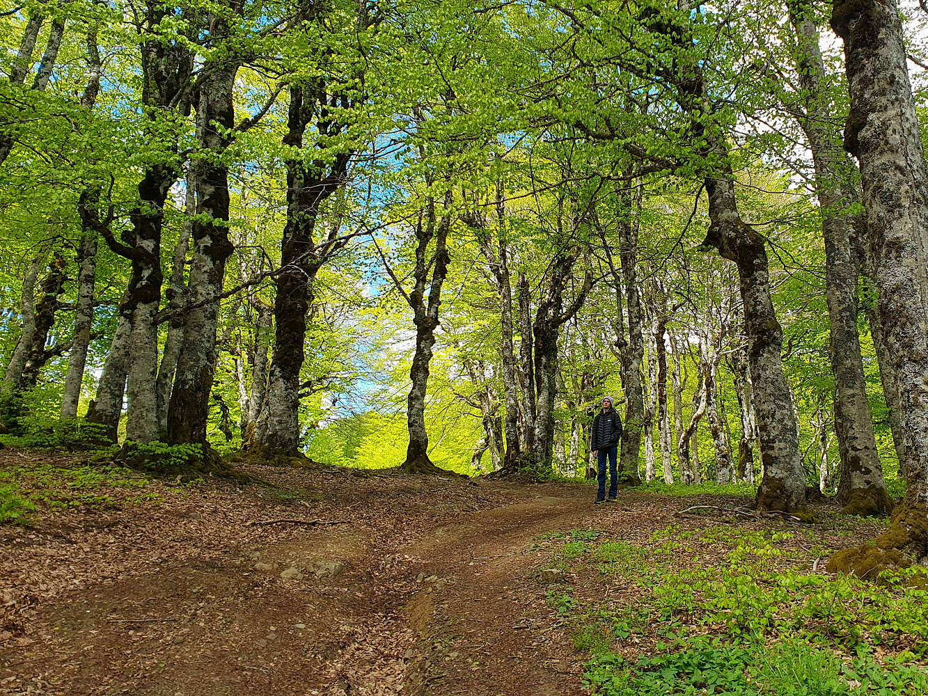
With Jason leading we made good time and were enjoying a view of the grassy ridge from this summit within 15 minutes, and having gained 100m in elevation we were unhappy to discover we were to lose it all! Alas Jason continued leading as we descended into the grassy crest, another 15 minutes and we were back at 1,670m. Now the summit bulge of Sarantaina (1,926m) [P-396] lay ahead of us and we steadily followed the markings up the ridge, step by step. On our right the silent and dense Beech forest provided a spooky ambiance on this overcast and eerily quiet day. The slog was steady and boring, but the friendly terrain meant we were making great time and soon had separated with the Beech and coasted on the summit ridge.
![Sarantaina (1,923m) [P-396] from the start of the ridge.](https://images-sp.summitpost.org/tr:e-sharpen,e-contrast-1,fit-max,q-60,h-1000/1085471.jpg)
Sarantaina (1,923m) [P-396] from the start of the ridge.
![Psilorachi (1,780m) [P-119] from the Oxia (1,923m) summit cone.](https://images-sp.summitpost.org/tr:e-sharpen,e-contrast-1,fit-max,q-60,h-1000/1085472.jpg)
Psilorachi (1,780m) [P-119] from the Oxia (1,923m) summit cone.
As we left the forest behind Jason led away and disappeared above the undulations of the ridge. I patiently waited for Terry, lagging a few minuted behind before continuing on the alpine shoulder, covered in tall yellow grass and littered with mildly loose pebbles. Navigating visually we moved right (N) and traversed under a forepeak, only to realize the trail was on the other side of the ridge. With a direct ascent of the steep slopes past the forepeak we rejoined the ridge and normal route, our safe but unnecessary “variant” gave an added feeling of exposure with us ascending a small slope veritably ending on a cliff above the N Face. Here the steepness finally lessened and the ridge welcomed us towards the top on a wide and pleasant cat-walk. Jason was too excited and had made his way to the summit already only to proclaim his want to return to the village by foot, a grueling >15km journey through remote forest. After shutting that idea down we enjoyed a short time on the summit in overcast conditions before heading down. On the descent we avoided hiking up the 100m to Psili Rachi (1,780m) [P-119] and instead traversed its NE aspect using a narrow maintained trail.
![Jason traversing under Psili Rachi (1,780m) [P-119].](https://images-sp.summitpost.org/tr:e-sharpen,e-contrast-1,fit-max,q-60,h-1000/1085474.jpg)
Jason traversing under Psili Rachi (1,780m) [P-119].
Upon our return to the car we decided to visit the village of Grammeni Oxia across the Pass in an attempt to buy some restaurant-cooked food, as none was available on the entire N aspect of the mountain for a good 40km. As soon as we pulled in and sat down a large downpour begun. While we avoided getting drenched, the mountain simply had to remind us of its treacherous nature. By the early evening its summit was again visible against the cobalt sky, accentuated by the orange hue of a wet spring sunset.
Interactive Map
Logistics
We visited Oxia (1,926m) [P-396] in May 2024 as part of an Orthodox Easter family vacation. We drove in and stayed on the less popular and almost forgotten Northern aspect of the massif. We primarily ventured around the area of Kanalia Valley below Pougakia, but went as far South as Grammeni Oxia village. On one occasion we had to drive back down to Sperchiada to acquire assorted supplies.
Groceries & fuel are generally unavailable on villages past the town of Sperchiada in Sperchios Valley. Visitors must plan ahead or expect to need to drive about 1 hour back down for any necessities.
Kedra Village
For the 5 or so days of our stay in the area we selected the only accommodation “Kedra Village”, a set of small wooden cabins. Due to the location there is a lack of alternatives both in terms of accommodation and dinning, and this is reflected in the cost of the stay. That being said the cabins were nicely appointed and due to a ‘slow’ season we were provided access to an even larger cabin. The hosts were fairly friendly and hospitable throughout, although the dinning operation lacks any variety, on account of being ran by 1 person. However, guests may have access to a kitchenette like we did and may be able to cook some of their own meals. Therefore, besides the food there is very little that can be noted about the core facilities. We would be remiss to mention that they also offer use of a hot-tub and sauna, as well as a small cold pool during the summer.
Besides the facilities maybe a comment on the animals living on the premises is warranted. Overall we saw more than 10 domestic animals, mainly cats, and in generally healthy condition, and surprisingly not too domesticated. One of the cats was in poor shape on account of a serious foot injury for which we were assured by the hosts that they were following the vet orders precisely for his treatment. The two main dogs were exceptional companions during my morning and evening walks and seemed to enjoy eating the Easter Sunday leftovers. The two hunting dogs of the owner, constantly left chained and barking were a bit of a different story, although an expected outcome for two well trained hunting dogs.

Nearby Peaks
The following are notable peaks nearby Oxia (1,926m) [P-396].
Vardoussia (2,495m) [P-1000]
Tymfristos (Velouchi) (2,315m) [P-1000]